 geodata-info
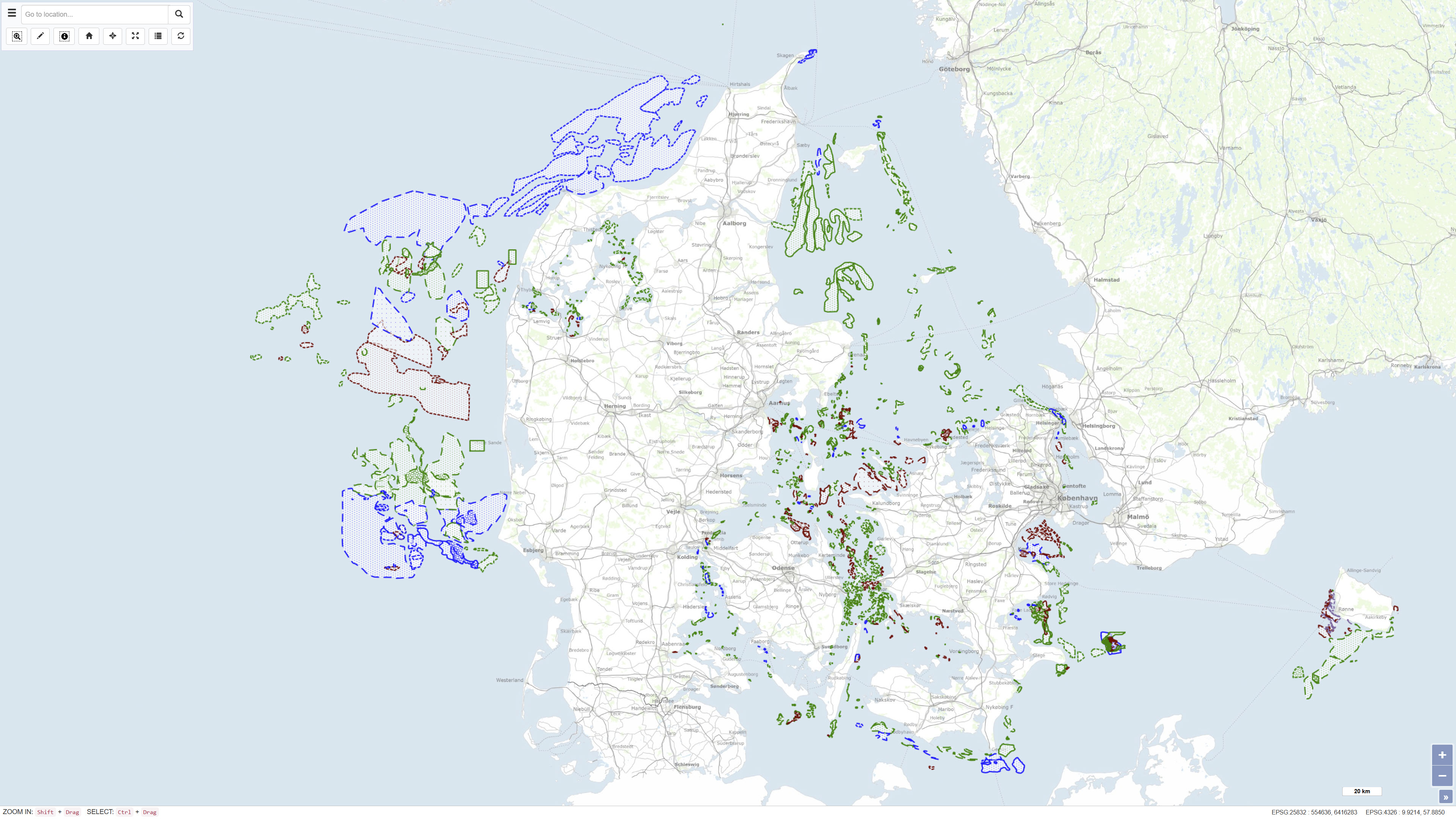
The marine raw material database, Marta
The MARTA database contains shallow seismic and acoustic data, information and geological samples. MATRA shows the distribution of marine sand and gravel resources and gives access to reports on raw material surveys. MARTA shows the distribution of marine sand and gravel resources and gives access to reports on raw material surveys. Data has primarily been acquired by GEUS and our partners., MARTA is the official Danish marine raw material database for data reported in accordance with the Danish Raw Material Act. MARTA is used by the raw materials industry and authorities and as a planning tool in connection with raw material extraction and marine construction projects including beach nourishment.
Simple
Identifikation
- Titel
-
The marine raw material database, Marta
Offentliggørelsestidspunkt
- Dato (Publication)
- 2019-01-01
Ansvarlig myndighed og kontaktoplysninger
- Kontakt vedr. service
-
Organisationsnavn E-mail adresse Rolle The Geological Survey of Denmark and Greenland (GEUS)
Point of contact The Geological Survey of Denmark and Greenland (GEUS)
Owner
- Metadata author
-
Organisationsnavn E-mail adresse Rolle The Geological Survey of Denmark and Greenland (GEUS)
Point of contact
Geografisk udstrækning
- Koordinatsystem
-
ETRS 89 / UTM 32N (EPSG:25832)
Nøgleord
- Nøgleord
-
Dataset
- Nøgleord
-
Geophysics
- Nøgleord
-
Shallow seismic
- Type
- Theme
- Nøgleord
- Energy and resources
- Type
- Theme
- Titel
- Forskningsemner
- Dato (Publication)
- 2025-11-03
- Nøgleord
- Denmark
- Type
- Place
- Titel
- Geografisk
- Dato (Publication)
- 2025-12-11
Kvalitet
- Type som metadata beskriver
- Dataset
- Beskrivelse
-
The MARTA database contains data from the late 1970s until today. Data acquired until the mid 1990s, in general, are only stored as analogue data in paper printout format. These data are, however, continuously being scanned and will during the coming years be available in digital formats. . Data younger than the mid-1990s are available in digital formats such as XTF sidescan sonar data and SEG-Y seismic data. The positioning has undergone a technological development from the inaccurate Decca positioning system to today's DGPS and RTK systems system with a meter-scale accuracy. For the analogue data older than approximately 1997 MARTA only provides metadata i.e. sailing lines and information on instrumentation.
For the digital data, MARTA provides access to the real data beside the metadata. The largest part of the digital data is free for download.
)))
