 geodata-info
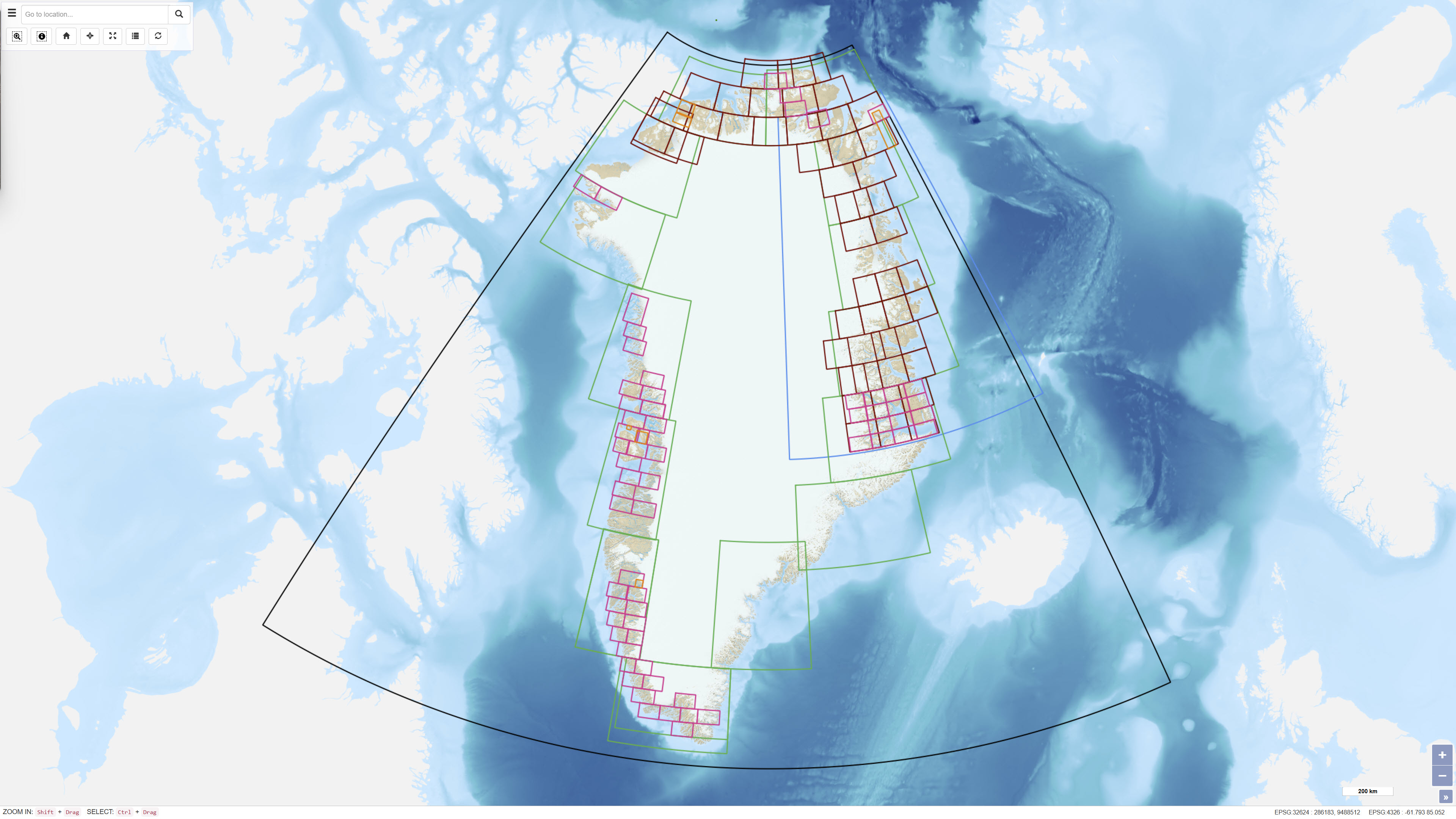
Index Layer of Published Geological Maps of Greenland
The dataset represents an index layer showing the geographic extent of geological maps of Greenland printed and published by the Geological Survey of Greenland (GGU) and the Geological Survey of Denmark and Greenland (GEUS) since 1957. The layer functions as a search and reference tool and does not contain the original map material. The dataset provides direct links to the GEUS Dataverse, where each map is assigned a DOI and can be downloaded as high-resolution TIFF images (400 dpi) or PDF files.
Simple
Identifikation
- Titel
-
Index Layer of Published Geological Maps of Greenland
Offentliggørelsestidspunkt
- Dato (Publication)
- 2022-01-01
Ansvarlig myndighed og kontaktoplysninger
- Kontakt vedr. service
-
Organisationsnavn E-mail adresse Rolle The Geological Survey of Denmark and Greenland (GEUS)
Point of contact
- Metadata author
-
Organisationsnavn E-mail adresse Rolle The Geological Survey of Denmark and Greenland (GEUS)
Point of contact
Geografisk udstrækning
- Koordinatsystem
-
WGS 84 / UTM 24N (EPSG:32624)
Nøgleord
- Nøgleord
-
Dataset
- Nøgleord
-
Geological Maps
- Nøgleord
-
Published Maps
- Nøgleord
-
Map Index
- Nøgleord
-
Greenland
- Nøgleord
-
Archive
- Type
- Theme
- Nøgleord
- Geoscience and history policy
- Nøgleord
- Tectonics and structural geology
- Nøgleord
- Stratigraphy and correlation
- Type
- Theme
- Titel
- Forskningsemner
- Dato (Publication)
- 2025-11-03
- Nøgleord
- Greenland
- Type
- Place
- Titel
- Geografisk
- Dato (Publication)
- 2025-12-11
Kvalitet
- Type som metadata beskriver
- Dataset
- Beskrivelse
-
The dataset has been established as a digital index layer based on records of geological maps published by GGU and GEUS. Geographic outlines have been digitised or registered to represent the spatial coverage of each published map. Each map entry is linked to a DOI in the GEUS Dataverse, where the digital version of the publication can be accessed and downloaded. The dataset does not contain the original map data.
)))
