 geodata-info
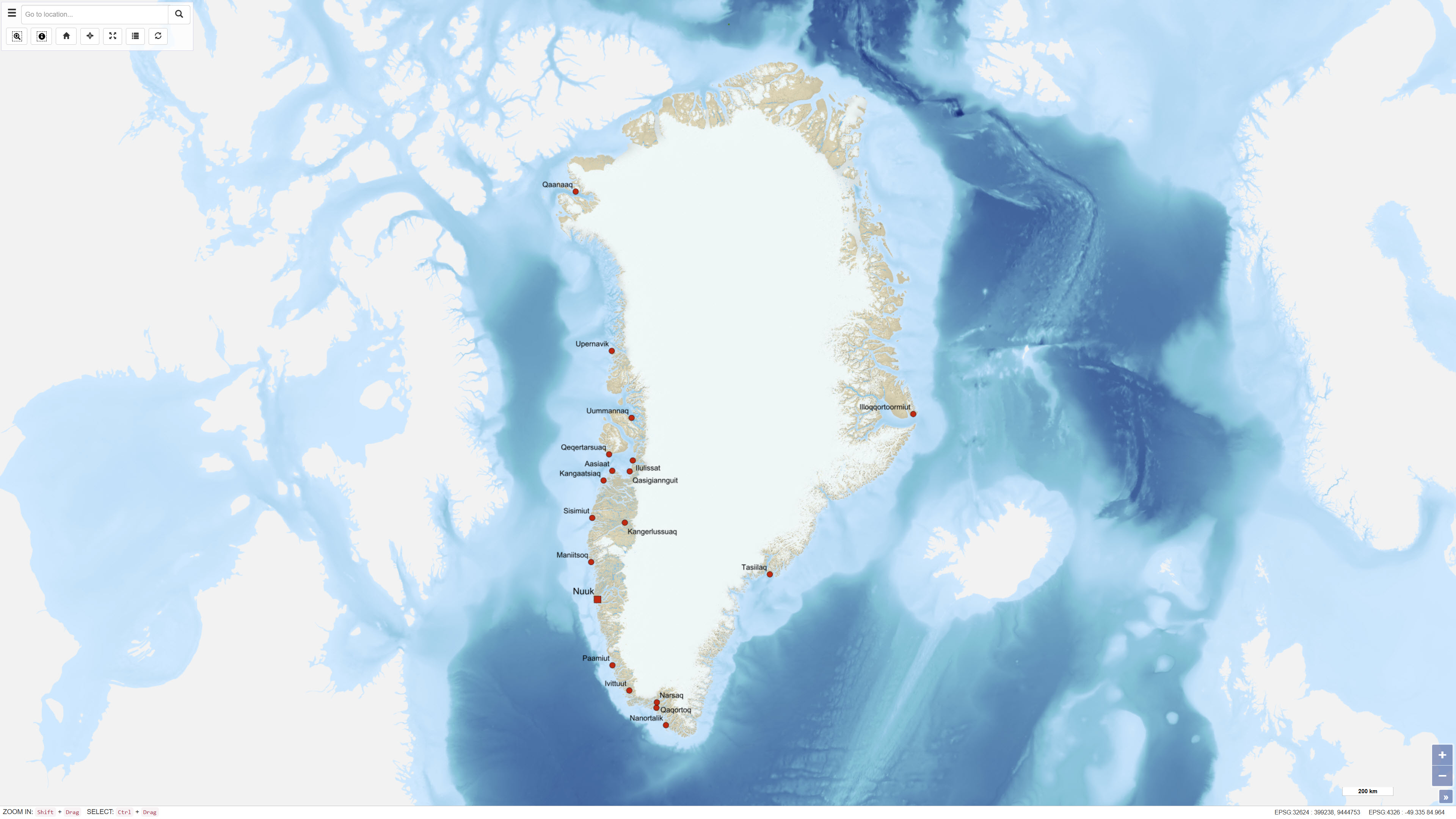
Towns, Settlements and Airfields in Greenland
The dataset contains terrain models of towns and settlements across Greenland delivered by Asiaq and prepared in connection with the Landslide Project 2022. The dataset includes recorded infrastructure such as roads, buildings and administrative boundaries, as well as a comprehensive raster mosaic of elevation models covering all towns and settlements.
Simple
Identifikation
- Titel
-
Towns, Settlements and Airfields in Greenland
Offentliggørelsestidspunkt
- Dato (Publication)
- 2018-04-09
Ansvarlig myndighed og kontaktoplysninger
- Kontakt vedr. service
-
Organisationsnavn E-mail adresse Rolle The Geological Survey of Denmark and Greenland (GEUS)
Point of contact
- Metadata author
-
Organisationsnavn E-mail adresse Rolle The Geological Survey of Denmark and Greenland (GEUS)
Point of contact
Geografisk udstrækning
- Koordinatsystem
-
WGS 84 / UTM 24N (EPSG:32624)
Nøgleord
- Nøgleord
-
Dataset
- Nøgleord
-
Towns
- Nøgleord
-
Settlements
- Nøgleord
-
Airfields
- Nøgleord
-
Greenland
- Type
- Theme
- Nøgleord
- Geoscience and history policy
- Type
- Theme
- Titel
- Forskningsemner
- Dato (Publication)
- 2025-11-03
- Nøgleord
- Greenland
- Type
- Place
- Titel
- Geografisk
- Dato (Publication)
- 2025-12-11
Kvalitet
- Type som metadata beskriver
- Dataset
- Beskrivelse
-
The dataset was delivered by Asiaq and prepared as part of the Landslide Project 2022. It consists of terrain models and associated infrastructure data compiled for towns and settlements across Greenland.

)))
