 geodata-info
DK model 2019 – Water resources assessment
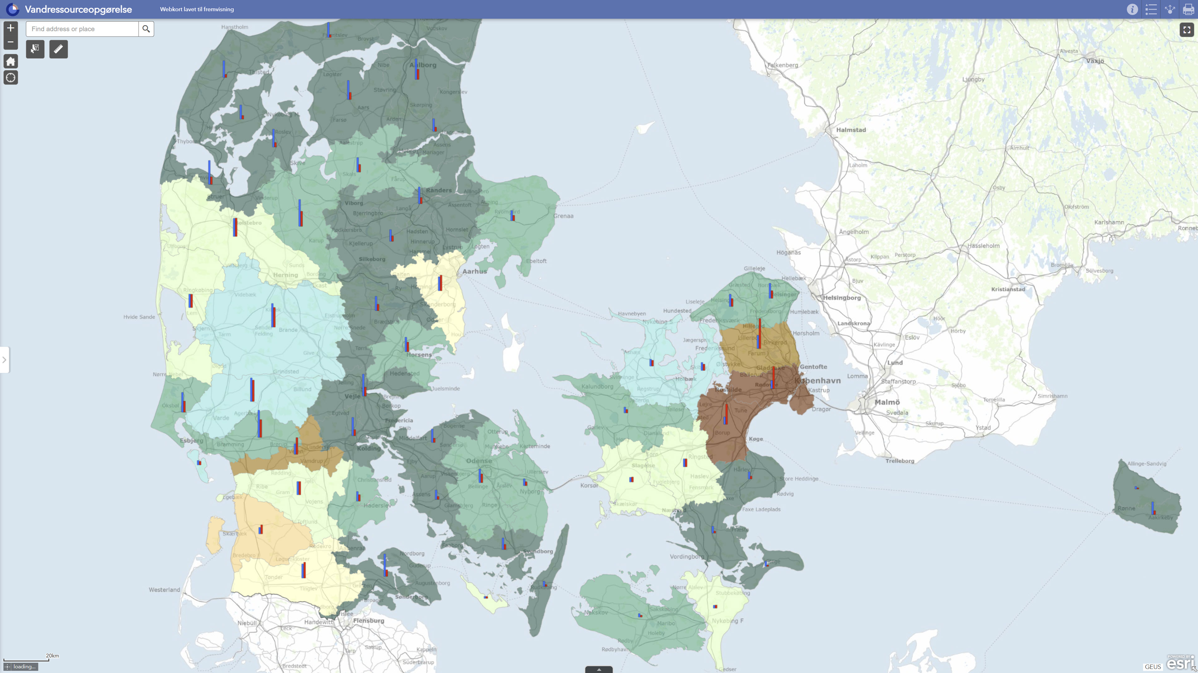
DK model 2019 – Water resources assessment comprises derived results from GEUS’ national hydrological model for Denmark for assessing the use and quantitative status of groundwater resources. The dataset contains model-based assessments of groundwater recharge, water abstraction, exploitation rates, water balance, groundwater drawdown and related assessments at groundwater body level. Exploitation rates are calculated as the ratio between abstraction and groundwater recharge and are used together with information on drawdown and streamflow impacts to assess whether groundwater bodies may be at risk with respect to water balance and quantitative status. The dataset is suitable for regional screening, documentation and overall assessment of groundwater resources, but should not be used as the sole basis for local-scale decisions without additional expert evaluation.
Simple
Identifikation
- Titel
-
DK model 2019 – Water resources assessment
Offentliggørelsestidspunkt
- Dato (Publication)
- 2022-01-01
Ansvarlig myndighed og kontaktoplysninger
- Kontakt vedr. service
-
Organisationsnavn E-mail adresse Rolle The Geological Survey of Denmark and Greenland (GEUS)
Point of contact
- Metadata author
-
Organisationsnavn E-mail adresse Rolle The Geological Survey of Denmark and Greenland (GEUS)
Point of contact
Geografisk udstrækning
- Koordinatsystem
-
ETRS 89 / UTM 32N (EPSG:25832)
Nøgleord
- Nøgleord
-
Dataset
- Nøgleord
-
Water resources assessment
- Nøgleord
-
Groundwater
- Nøgleord
-
Exploitation rate
- Nøgleord
-
Water balance
- Nøgleord
-
Drawdown
- Nøgleord
-
Quantitative status
- Type
- Theme
- Nøgleord
- Hydrology
- Type
- Theme
- Titel
- Forskningsemner
- Dato (Publication)
- 2025-11-03
- Nøgleord
- Denmark
- Type
- Place
- Titel
- Geografisk
- Dato (Publication)
- 2025-12-11
Kvalitet
- Type som metadata beskriver
- Dataset
- Beskrivelse
-
The water resources assessment is derived from dynamic model calculations with DK model 2019, GEUS’ national hydrological model for Denmark. The model was updated with new groundwater bodies, new hydrogeological mapping information and a new calibration against observed groundwater heads and stream discharge. For each groundwater body, inflow and groundwater recharge were assessed on the basis of the hydrogeological model, including downward, upward and horizontal flow components. Water abstractions were incorporated for the individual groundwater bodies for the same calculation period. Exploitation rates were calculated as the ratio between total abstraction and total groundwater recharge for the period 2011–2017. The results were used for water balance testing and assessment of groundwater bodies where the exploitation rate under current abstraction conditions may indicate a risk of poor quantitative status. The assessment has subsequently been published as GIS layers and webGIS through GEUS’ data portal.
)))
