 geodata-info
Greenland Geochronology Database
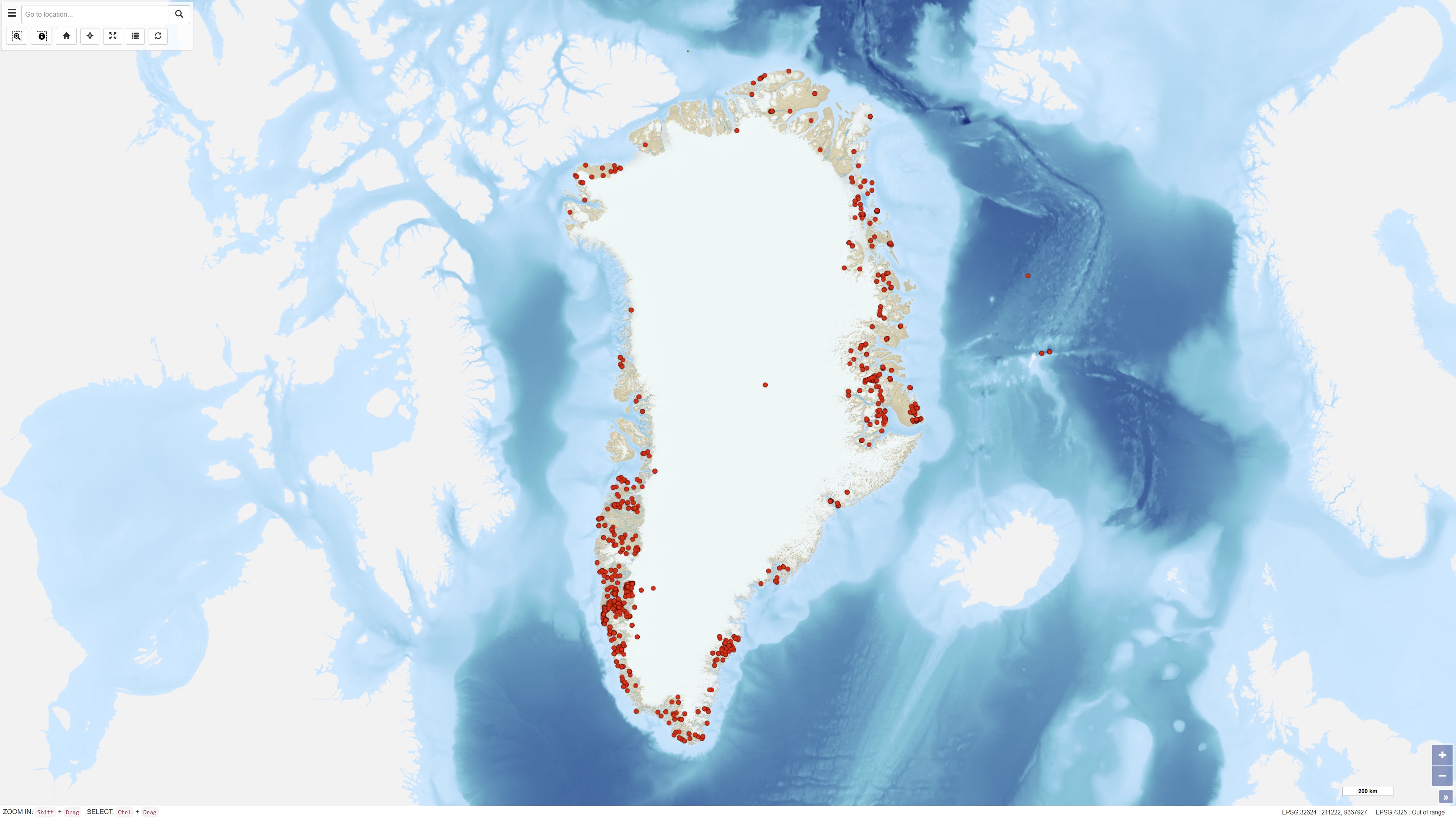
The Greenland Geochronology Database is a systematic compilation of published U-Pb geochronological data from Greenland. The dataset integrates age determinations from a wide range of scientific publications and normalises isotopic ratios and uncertainties into a consistent format, with all analytical errors reported at the 1 sigma level. Ratios have been verified against reported ages and corrected where necessary to ensure internal consistency. The database is structured to enable efficient querying and cross-comparison of geochronological information derived using different analytical standards.
Simple
Identifikation
- Titel
-
Greenland Geochronology Database
Offentliggørelsestidspunkt
- Dato (Publication)
- 2022-01-01
Ansvarlig myndighed og kontaktoplysninger
- Kontakt vedr. service
-
Organisationsnavn E-mail adresse Rolle The Geological Survey of Denmark and Greenland (GEUS)
Point of contact The Geological Survey of Denmark and Greenland (GEUS)
Point of contact
- Metadata author
-
Organisationsnavn E-mail adresse Rolle The Geological Survey of Denmark and Greenland (GEUS)
Point of contact
Geografisk udstrækning
- Koordinatsystem
-
WGS 84 / UTM 24N (EPSG:32624)
Nøgleord
- Nøgleord
-
Dataset
- Nøgleord
-
Geochronology
- Nøgleord
-
Isotope Dating
- Nøgleord
-
Age Determination
- Nøgleord
-
Geochronological Database
- Nøgleord
-
Greenland
- Nøgleord
-
Database
- Type
- Theme
- Nøgleord
- Stratigraphy and correlation
- Type
- Theme
- Titel
- Forskningsemner
- Dato (Publication)
- 2025-11-03
- Nøgleord
- Greenland
- Type
- Place
- Titel
- Geografisk
- Dato (Publication)
- 2025-12-11
Kvalitet
- Type som metadata beskriver
- Dataset
- Beskrivelse
-
The dataset was established through systematic collation of published U-Pb geochronological analyses from the scientific literature. Original isotopic ratios and uncertainties were recast into a consistent format, with all errors reported at the 1 sigma level. Ratios were verified against reported ages and corrected where inconsistencies were identified to ensure internal coherence. The dataset represents a compilation rather than primary laboratory measurements.
)))
