 geodata-info
Regional Geochemical Analyses of Scree Samples from Greenland
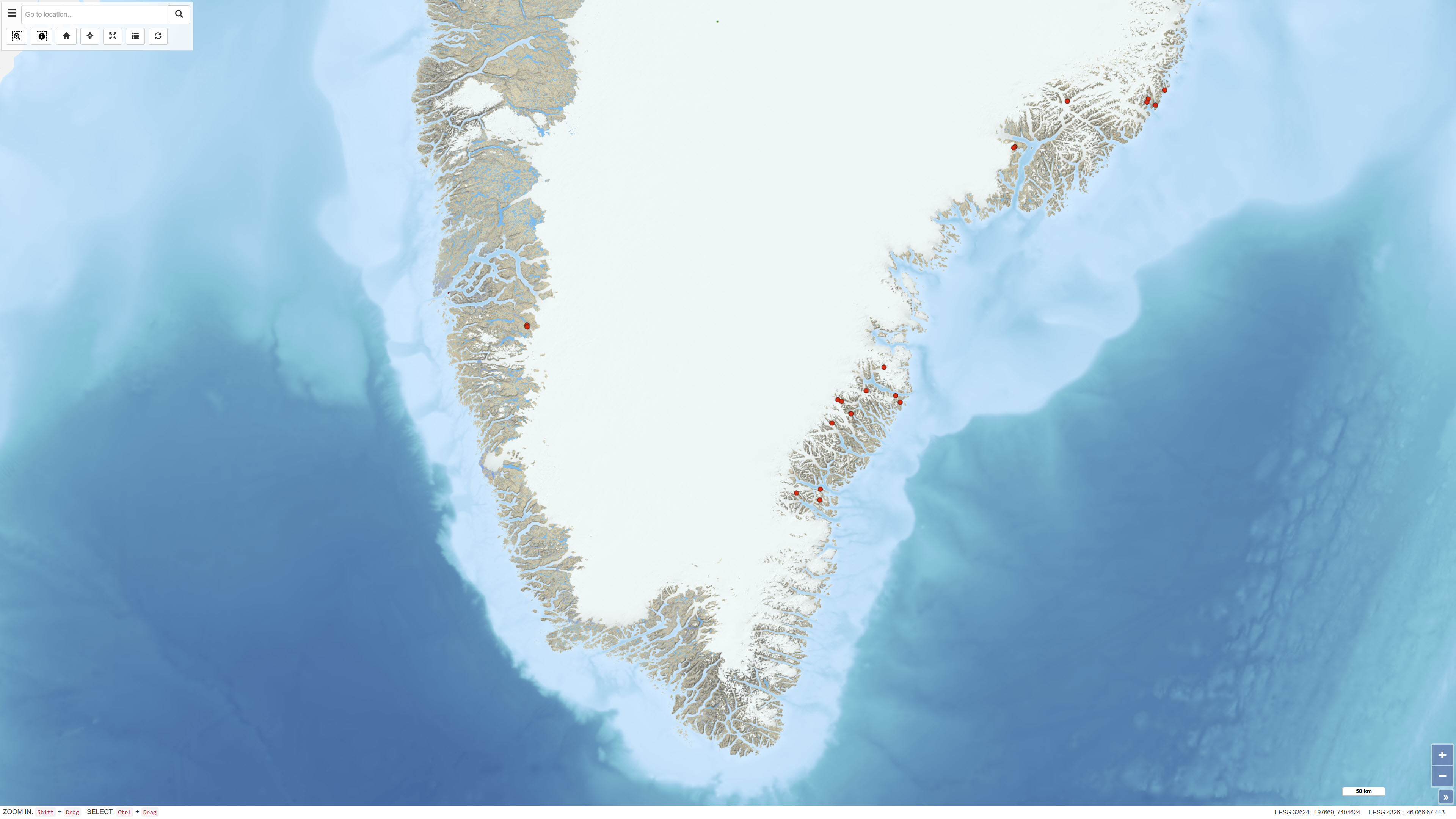
The dataset contains geochemical analyses of 49 scree (talus) samples collected in Greenland as part of regional geochemical mapping programmes conducted by the Geological Survey of Greenland (GGU), later GEUS, between 1977 and 1997. Scree samples were collected in areas where neither stream sediment nor soil sampling was feasible. The samples represent near-surface material derived from local bedrock and were analysed for major and trace elements using laboratory methods available at the time of collection. The dataset supplements regional geochemical data from stream sediment and soil samples and forms part of the overall basis for geochemical mapping in Greenland.
Simple
Identifikation
- Titel
-
Regional Geochemical Analyses of Scree Samples from Greenland
Offentliggørelsestidspunkt
- Dato (Publication)
- 2022-01-01
Ansvarlig myndighed og kontaktoplysninger
- Kontakt vedr. service
-
Organisationsnavn E-mail adresse Rolle The Geological Survey of Denmark and Greenland (GEUS)
Point of contact
- Metadata author
-
Organisationsnavn E-mail adresse Rolle The Geological Survey of Denmark and Greenland (GEUS)
Point of contact
Geografisk udstrækning
- Koordinatsystem
-
WGS 84 / UTM 24N (EPSG:32624)
Nøgleord
- Nøgleord
-
Dataset
- Nøgleord
-
Geochemistry
- Nøgleord
-
Scree
- Nøgleord
-
Surface Material
- Nøgleord
-
Trace Elements
- Nøgleord
-
Major Elements
- Nøgleord
-
Mineral Exploration
- Nøgleord
-
Greenland
- Type
- Theme
- Nøgleord
- Soils and biogeochemistry
- Nøgleord
- Sedimentary rocks and processes
- Type
- Theme
- Titel
- Forskningsemner
- Dato (Publication)
- 2025-11-03
- Nøgleord
- Greenland
- Type
- Place
- Titel
- Geografisk
- Dato (Publication)
- 2025-12-11
Kvalitet
- Type som metadata beskriver
- Dataset
- Beskrivelse
-
The scree samples were collected during regional geochemical reconnaissance surveys carried out by the Geological Survey of Greenland (GGU) between 1977 and 1997. Sampling was conducted in areas where stream sediment and soil sampling could not be performed. Samples were dried, sieved and analysed at various laboratories using methods such as X-ray Fluorescence Spectrometry (XRF), Instrumental Neutron Activation Analysis (INA) and Delayed Neutron Counting (DNC), depending on survey period and element suite. Analytical data are recorded as reported by the laboratories. Values below detection limits are stored as negative values in the dataset. Detection limits and analytical precision vary between methods and survey periods.
)))
