 geodata-info
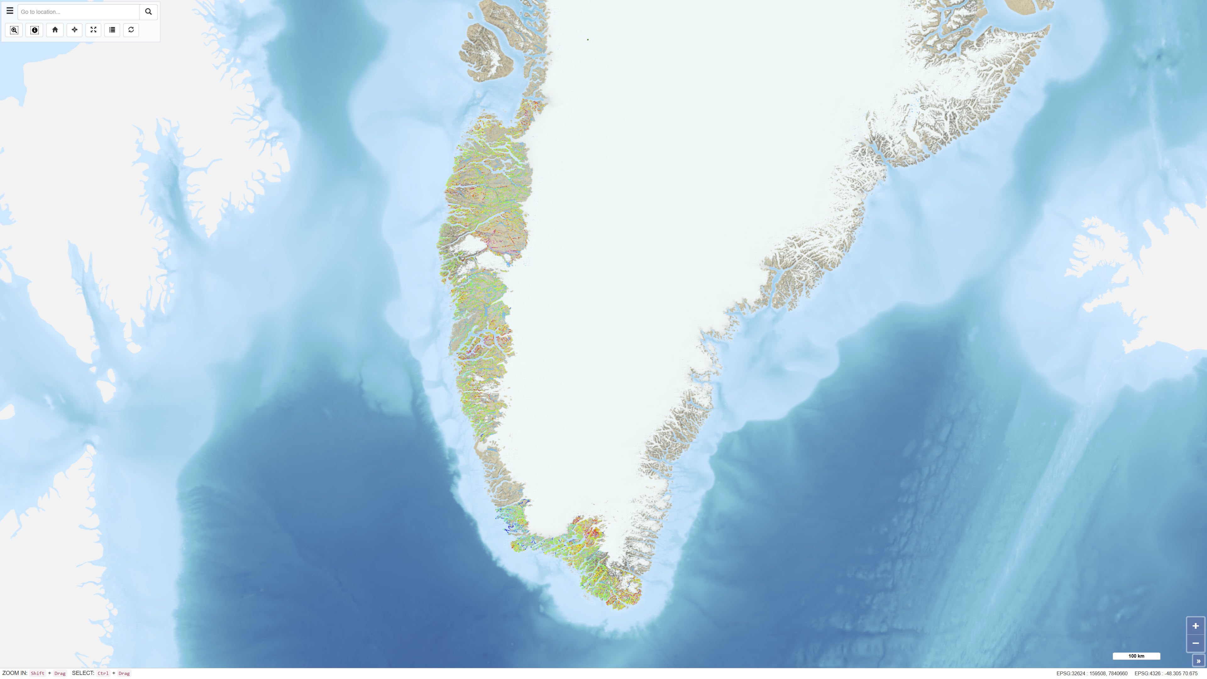
Regional Airborne Radiometric Surveys in Greenland 1975–1982
The dataset comprises regional airborne radiometric measurements acquired in Greenland during 1975–1982 as part of systematic geophysical mapping programmes. The measurements were collected using aircraft-mounted gamma spectrometers and record natural gamma radiation from potassium (K), thorium (Th) and uranium (U). The surveys covered large parts of Greenland and were conducted to support regional geological mapping and mineral exploration. The data constitute a historical geophysical reference dataset for analyses of near-surface lithological variations and the distribution of radioactive elements.
Simple
Identifikation
- Titel
-
Regional Airborne Radiometric Surveys in Greenland 1975–1982
Offentliggørelsestidspunkt
- Dato (Publication)
- 2022-01-01
Ansvarlig myndighed og kontaktoplysninger
- Kontakt vedr. service
-
Organisationsnavn E-mail adresse Rolle The Geological Survey of Denmark and Greenland (GEUS)
Point of contact
- Metadata author
-
Organisationsnavn E-mail adresse Rolle The Geological Survey of Denmark and Greenland (GEUS)
Point of contact
Geografisk udstrækning
- Koordinatsystem
-
WGS 84 / UTM 24N (EPSG:32624)
Nøgleord
- Nøgleord
-
Dataset
- Nøgleord
-
Geophysics
- Nøgleord
-
Radiometry
- Nøgleord
-
Potassium
- Nøgleord
-
Thorium
- Nøgleord
-
Uranium
- Nøgleord
-
Greenland
- Nøgleord
-
Airborne
- Type
- Theme
- Nøgleord
- Energy and resources
- Nøgleord
- Tectonics and structural geology
- Type
- Theme
- Titel
- Forskningsemner
- Dato (Publication)
- 2025-11-03
- Nøgleord
- Greenland
- Type
- Place
- Titel
- Geografisk
- Dato (Publication)
- 2025-12-11
Kvalitet
- Type som metadata beskriver
- Dataset
- Beskrivelse
-
The dataset is based on airborne radiometric measurements acquired during 1975–1982. Data were collected using aircraft-mounted gamma spectrometers measuring natural gamma radiation from potassium, thorium and uranium. The surveys were conducted as part of regional geophysical mapping activities and subsequently processed using standard corrections, including altitude correction, background correction and calibration against known reference areas. The digital dataset has been established based on the original measurements and associated survey documentation.
)))
