 geodata-info
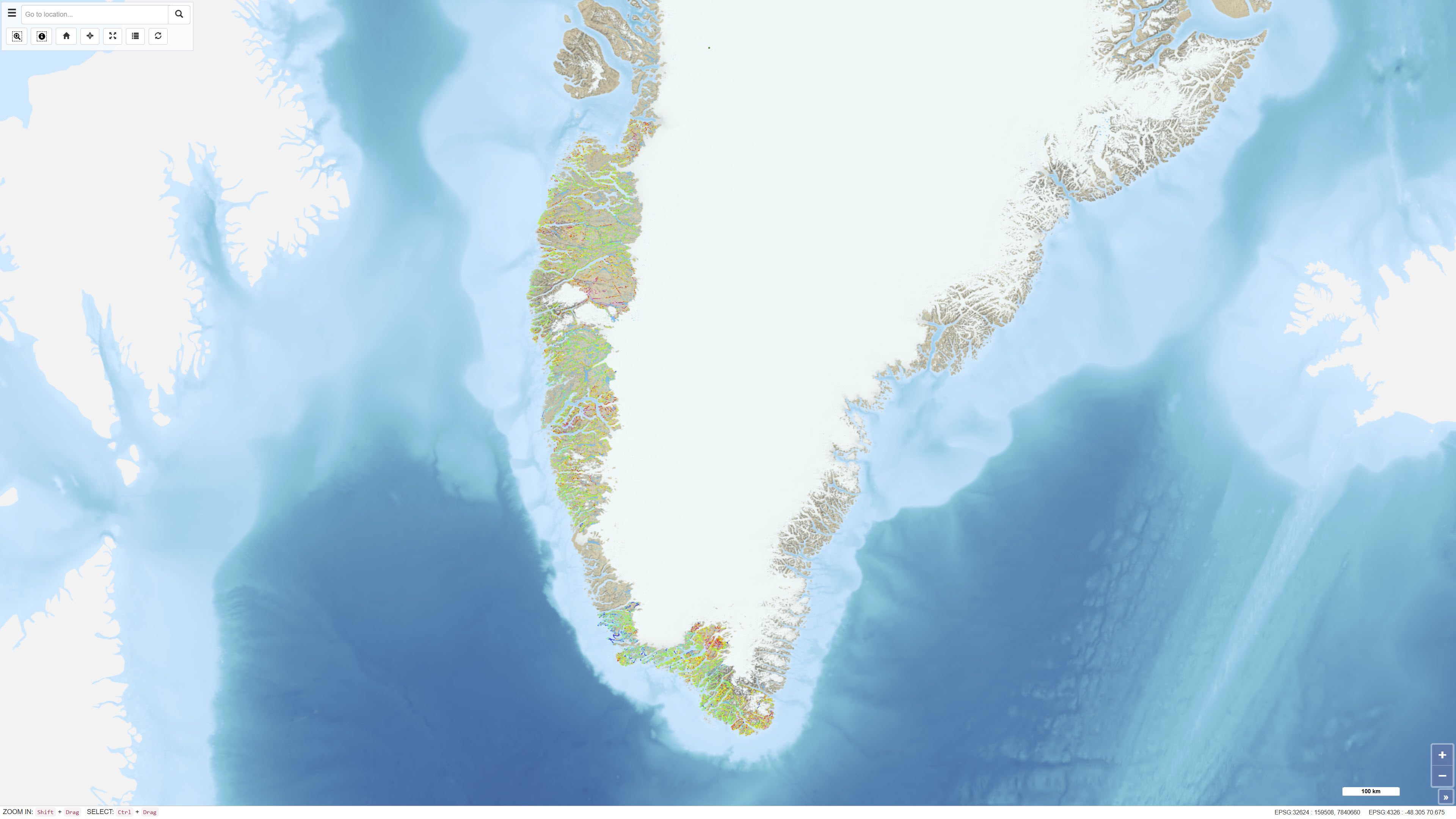
Regional Luftbåren Radiometri i Grønland 1975–1982
Regional Airborne Radiometric Surveys in Greenland 1975–1982
Datasættet omfatter regionale luftbårne radiometriske målinger udført i Grønland i perioden 1975–1982 som led i systematiske geofysiske kortlægningsprogrammer. Målingerne blev indsamlet med flybårne gammaspektrometre og registrerer naturlig gammastråling fra kalium (K), thorium (Th) og uran (U). Surveyene dækkede større dele af Grønland og blev gennemført for at understøtte regional geologisk kortlægning og råstofefterforskning. Data udgør et historisk geofysisk referencegrundlag for analyser af overfladenære litologiske variationer og radioaktive elementers fordeling.
The dataset comprises regional airborne radiometric measurements acquired in Greenland during 1975–1982 as part of systematic geophysical mapping programmes. The measurements were collected using aircraft-mounted gamma spectrometers and record natural gamma radiation from potassium (K), thorium (Th) and uranium (U). The surveys covered large parts of Greenland and were conducted to support regional geological mapping and mineral exploration. The data constitute a historical geophysical reference dataset for analyses of near-surface lithological variations and the distribution of radioactive elements.
Simple
Identifikation
- Titel
-
Regional Luftbåren Radiometri i Grønland 1975–1982
Regional Airborne Radiometric Surveys in Greenland 1975–1982
Offentliggørelsestidspunkt
-
Dato (Publication)Dato (Publication)
- 2022-01-01
Ansvarlig myndighed og kontaktoplysninger
- Kontakt vedr. service
-
Organisationsnavn E-mail adresse Rolle De Nationale Geologiske Undersøgelser for Danmark og Grønland (GEUS)
The Geological Survey of Denmark and Greenland (GEUS)
Point of contactPoint of contact
- Metadata author
-
Organisationsnavn E-mail adresse Rolle De Nationale Geologiske Undersøgelser for Danmark og Grønland (GEUS)
The Geological Survey of Denmark and Greenland (GEUS)
Point of contactPoint of contact
Geografisk udstrækning
- Koordinatsystem
-
WGS 84 / UTM 24N (EPSG:32624)
WGS 84 / UTM 24N (EPSG:32624)
Nøgleord
-
NøgleordNøgleord
-
Datasæt
Dataset
-
NøgleordNøgleord
-
Geofysik
Geophysics
-
NøgleordNøgleord
-
Radiometri
Radiometry
-
NøgleordNøgleord
-
Kalium
Potassium
-
NøgleordNøgleord
-
Thorium
Thorium
-
NøgleordNøgleord
-
Uran
Uranium
-
NøgleordNøgleord
-
Grønland
Greenland
-
NøgleordNøgleord
-
Luftbåren
Airborne
-
TypeType
-
ThemeTheme
-
NøgleordNøgleord
-
Energi og ressourcerEnergy and resources
-
NøgleordNøgleord
-
Tektonik og strukturgeologiTectonics and structural geology
-
TypeType
-
ThemeTheme
-
Titel
-
Forskningsemner
-
Dato (Publication)Dato (Publication)
- 2025-11-03
-
NøgleordNøgleord
-
GrønlandGreenland
-
TypeType
-
PlacePlace
-
Titel
-
Geografisk
-
Dato (Publication)Dato (Publication)
- 2025-12-11
Kvalitet
-
Type som metadata beskriverType som metadata beskriver
-
DatasetDataset
-
BeskrivelseBeskrivelse
-
Datasættet er baseret på luftbårne radiometriske målinger udført i perioden 1975–1982. Data blev indsamlet ved anvendelse af flybårne gammaspektrometre, som målte den naturlige gammastråling fra kalium, thorium og uran. Målingerne blev gennemført som led i regionale geofysiske kortlægningsaktiviteter og efterfølgende behandlet med standardkorrektioner, herunder højdekorrektion, baggrundskorrektion og kalibrering mod kendte referenceområder. De digitale datasæt er etableret på baggrund af de oprindelige målinger og tilhørende dokumentation fra de gennemførte surveys.
The dataset is based on airborne radiometric measurements acquired during 1975–1982. Data were collected using aircraft-mounted gamma spectrometers measuring natural gamma radiation from potassium, thorium and uranium. The surveys were conducted as part of regional geophysical mapping activities and subsequently processed using standard corrections, including altitude correction, background correction and calibration against known reference areas. The digital dataset has been established based on the original measurements and associated survey documentation.
)))
