 geodata-info
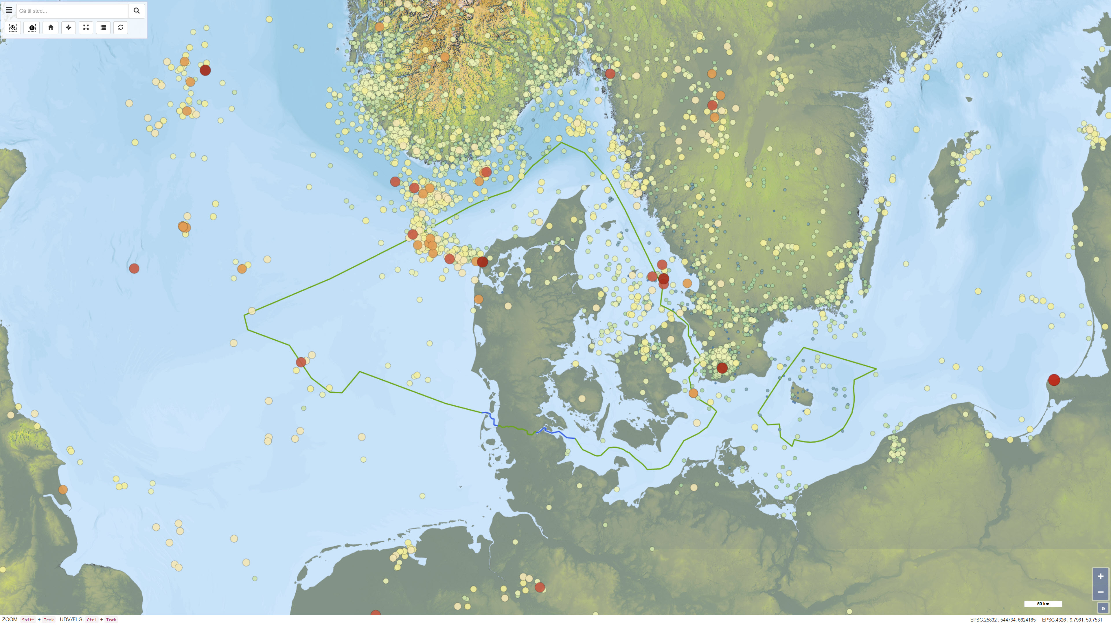
Recorded earthquakes in Denmark
This dataset provides a national overview of all registered earthquakes in Denmark, including time, location, depth and magnitude. The recordings are based on data from GEUS’ national seismic network and comprise both measured earthquakes and subsequently quality-assured observations. The dataset is continuously updated and reflects the best scientific assessment of seismic activity in Denmark, where improved instrumentation and analysis today allow detection of much weaker tremors than historically.
Simple
Identifikation
- Titel
-
Recorded earthquakes in Denmark
Offentliggørelsestidspunkt
- Dato (Publication)
- 2025-05-20
Ansvarlig myndighed og kontaktoplysninger
- Kontakt vedr. service
-
Organisationsnavn E-mail adresse Rolle The Geological Survey of Denmark and Greenland (GEUS)
Point of contact The Geological Survey of Denmark and Greenland (GEUS)
Custodian The Geological Survey of Denmark and Greenland (GEUS)
Custodian The Geological Survey of Denmark and Greenland (GEUS)
Custodian The Geological Survey of Denmark and Greenland (GEUS)
Publisher
- Metadata author
-
Organisationsnavn E-mail adresse Rolle The Geological Survey of Denmark and Greenland (GEUS)
Point of contact
Geografisk udstrækning
- Koordinatsystem
-
ETRS 89 / UTM 32N (EPSG:25832)
Nøgleord
- Nøgleord
-
Dataset
- Nøgleord
-
Seismology
- Nøgleord
-
Earthquake
- Nøgleord
-
Database
- Type
- Theme
- Nøgleord
- Tectonics and structural geology
- Type
- Theme
- Titel
- Forskningsemner
- Dato (Publication)
- 2025-11-03
- Nøgleord
- Denmark
- Type
- Place
- Titel
- Geografisk
- Dato (Publication)
- 2025-12-11
Kvalitet
- Type som metadata beskriver
- Dataset
- Beskrivelse
-
The dataset is based on observations from GEUS’ national seismic network and associated seismographs that continuously record seismic activity in Denmark and surrounding areas. The recordings are automatically collected in the GEUS earthquake database and subsequently subjected to both automated and manual quality control performed by seismologists. As part of the quality-assurance process, non-seismic events, including explosions caused by military activities or other anthropogenic sources, are identified and removed. The dataset represents an ongoing interpretation of seismic measurements and reflects the data basis, instrumentation and analysis methods applied at the time of registration.
)))
