 geodata-info
Geological map of Denmark, 1:200,000 - The Danish Central Graben: Base Chalk and Chalk Group
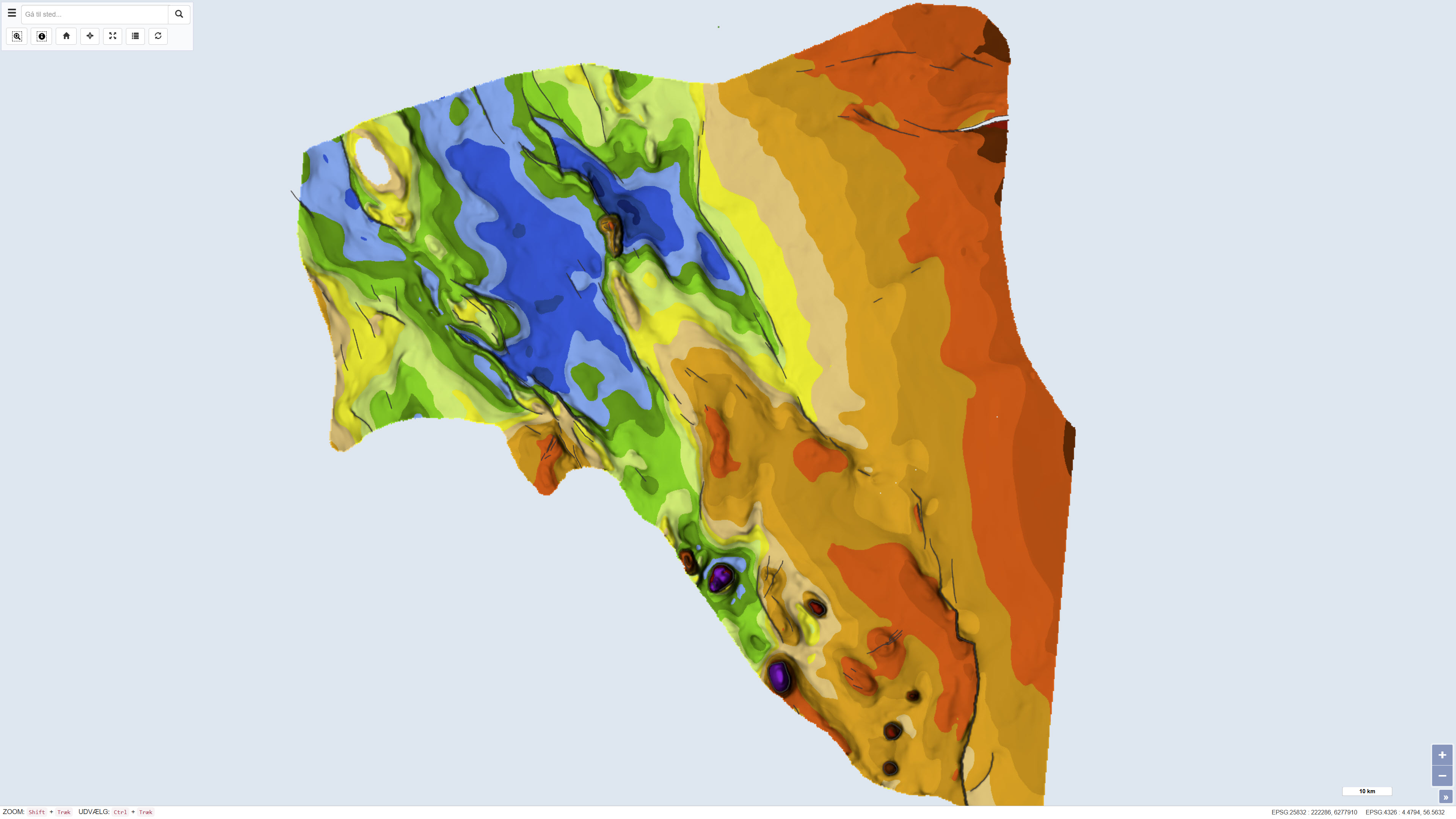
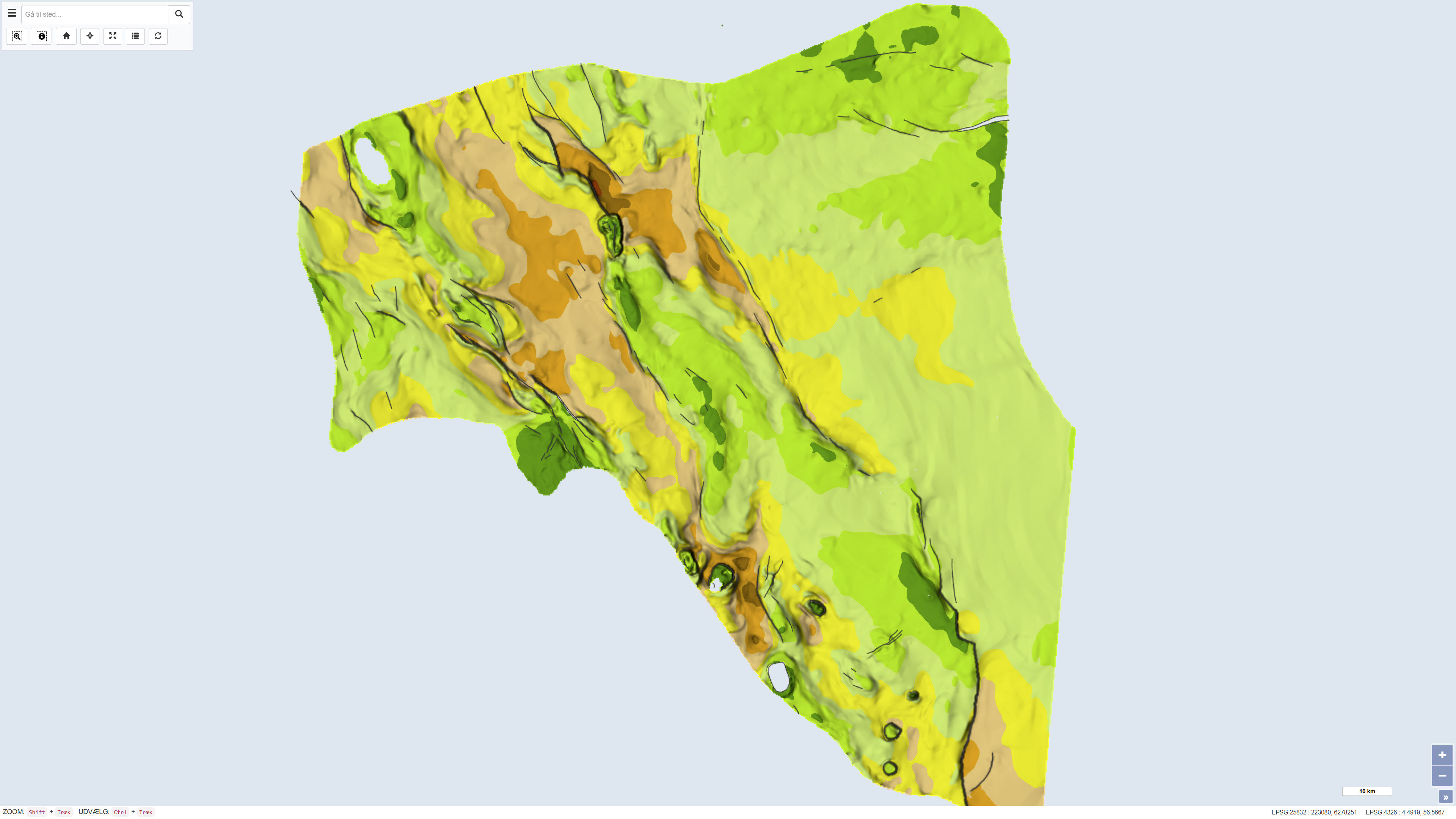
The dataset comprises a geological map of the Danish Central Graben at a scale of 1:200,000 presenting regional maps of ‘Base Chalk’ and the Chalk Group in terms of two-way travel time, depth, interval velocity and vertical thickness (isochore). The map was published in 1995 as part of the DGU Map Series no. 48 and was produced as part of a comprehensive geological mapping of the Danish Central Graben. The mapping is based on regional interpretation of seismic data supplemented by information from boreholes. The map covers the Danish part of the Central Graben and parts of the eastern North Sea, and adjacent areas in the Norwegian, British and German sectors are included in order to define regional structural relationships. The map sheet consists of several thematic sub-maps that together describe the structure and stratigraphy of the area.
Simple
Identifikation
- Titel
-
Geological map of Denmark, 1:200,000 - The Danish Central Graben: Base Chalk and Chalk Group
Offentliggørelsestidspunkt
- Dato (Publication)
- 1995-05-19
Ansvarlig myndighed og kontaktoplysninger
- Kontakt vedr. service
-
Organisationsnavn E-mail adresse Rolle The Geological Survey of Denmark and Greenland (GEUS)
Point of contact
- Metadata author
-
Organisationsnavn E-mail adresse Rolle The Geological Survey of Denmark and Greenland (GEUS)
Point of contact
Geografisk udstrækning
- Koordinatsystem
-
ETRS 89 / UTM 32N (EPSG:25832)
Nøgleord
- Nøgleord
-
Dataset
- Nøgleord
-
Geology
- Nøgleord
-
Central Graben
- Nøgleord
-
Base Chalk
- Nøgleord
-
Chalk Group
- Nøgleord
-
Stratigraphy
- Nøgleord
-
North Sea
- Nøgleord
-
Denmark
- Type
- Theme
- Nøgleord
- Geoscience and history policy
- Nøgleord
- Stratigraphy and correlation
- Nøgleord
- Tectonics and structural geology
- Type
- Theme
- Titel
- Forskningsemner
- Dato (Publication)
- 2025-11-03
- Nøgleord
- Denmark
- Type
- Place
- Titel
- Geografisk
- Dato (Publication)
- 2025-12-11
Kvalitet
- Type som metadata beskriver
- Dataset
- Beskrivelse
-
The map was published as DGU Map Series no. 48 in 1995 and was produced based on regional interpretation of seismic data supplemented by information from boreholes. The mapping work is based on seismic surveys acquired during the early and mid-1980s as well as proprietary datasets. The seismic interpretations were used to compile regional maps of two-way travel time and depth to Base Chalk as well as interval velocity and thickness maps of the Chalk Group. The dataset represents the geological and geophysical interpretation available at the time of publication.
)))
