 geodata-info
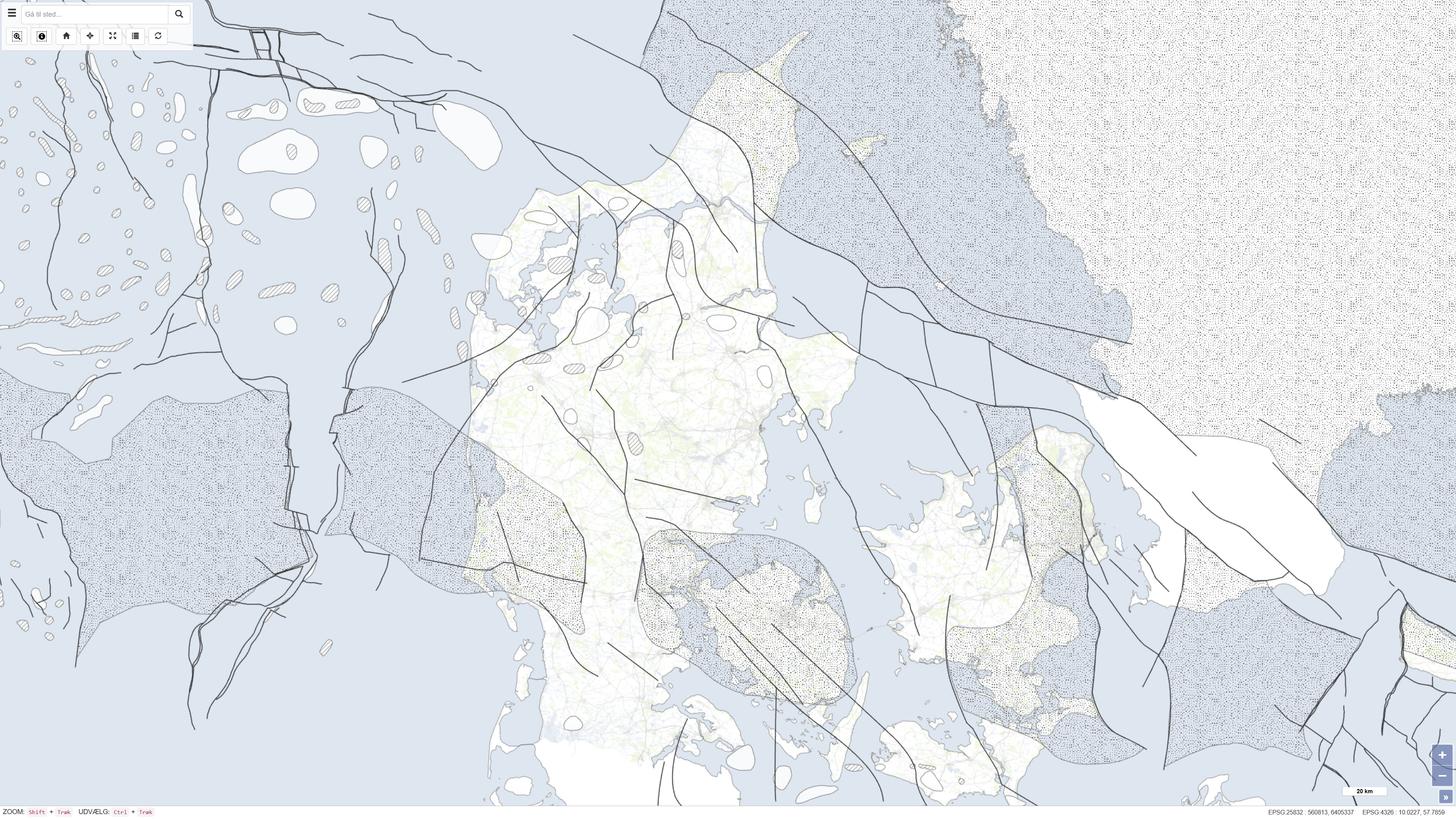
Structural features in the Danish area
This dataset is based on the Geological Survey of Denmark map series no. 45 and represents a compiled geological map product produced in the early 1990s. The map is based on existing geological maps, seismic surveys, and previous interpretations, providing a regional overview of the geological conditions within the mapped area. The dataset forms part of the national mapping activities of the Geological Survey of Denmark and was published in 1994.
Simple
Identifikation
- Titel
-
Structural features in the Danish area
Offentliggørelsestidspunkt
- Dato (Publication)
- 1994-01-01
Ansvarlig myndighed og kontaktoplysninger
- Kontakt vedr. service
-
Organisationsnavn E-mail adresse Rolle The Geological Survey of Denmark and Greenland (GEUS)
Point of contact
- Metadata author
-
Organisationsnavn E-mail adresse Rolle The Geological Survey of Denmark and Greenland (GEUS)
Point of contact
Geografisk udstrækning
- Koordinatsystem
-
ETRS 89 / UTM 32N (EPSG:25832)
Nøgleord
- Nøgleord
-
Dataset
- Nøgleord
-
Geology
- Nøgleord
-
Subsurface
- Nøgleord
-
Denmark
- Nøgleord
-
Structures
- Type
- Theme
- Nøgleord
- Tectonics and structural geology
- Type
- Theme
- Titel
- Forskningsemner
- Dato (Publication)
- 2025-11-03
- Nøgleord
- Denmark
- Type
- Place
- Titel
- Geografisk
- Dato (Publication)
- 2025-12-11
Kvalitet
- Type som metadata beskriver
- Dataset
- Beskrivelse
-
The dataset was produced by the Geological Survey of Denmark as part of map series no. 45 and is based on compilation and interpretation of existing geological maps, seismic data, and previous investigations. The map was produced in the early 1990s and reflects the data availability and interpretation level at the time of publication. The production was carried out under the auspices of the Geological Survey of Denmark within the Ministry of Environment and Energy.
)))
