 geodata-info
Greenland Mineral Resource Assessment Tracts
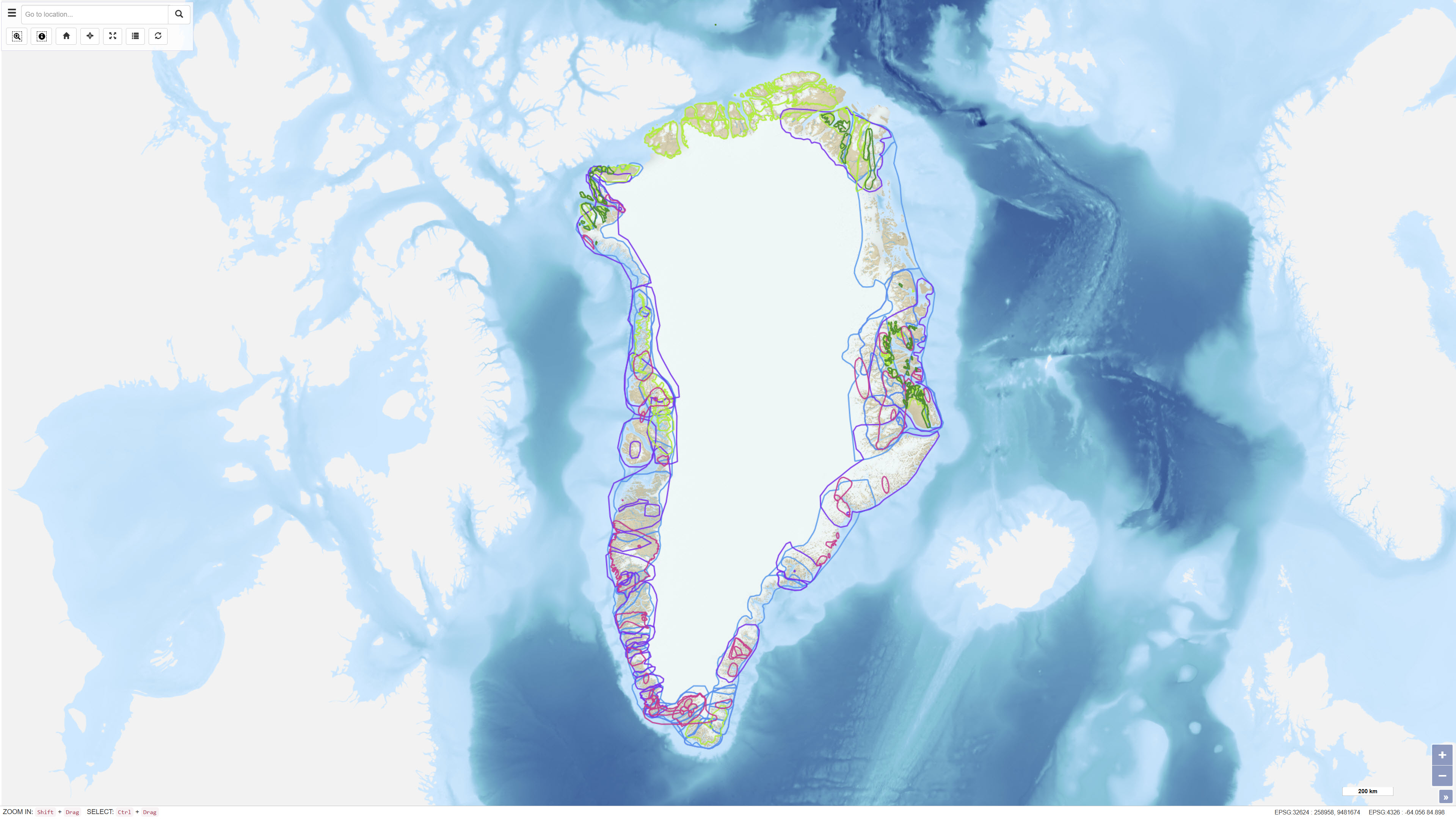
The dataset comprises spatial polygons (Tracts) representing areas in Greenland assessed as geologically permissive for specific mineral deposit types during mineral resource assessment workshops conducted between 2009 and 2014. Assessments were carried out following the principles of the U.S. Geological Survey “three-part quantitative assessment” method (Singer, 1993), except for the 2010 rare earth elements workshop. For each Tract, probabilistic estimates of the number of undiscovered deposits at different confidence levels are provided, along with statistical results from Monte Carlo simulations based on established grade-tonnage models. The assessments do not include economic, technical, environmental or social considerations.
Simple
Identifikation
- Titel
-
Greenland Mineral Resource Assessment Tracts
Offentliggørelsestidspunkt
- Dato (Publication)
- 2011-10-11
Ansvarlig myndighed og kontaktoplysninger
- Kontakt vedr. service
-
Organisationsnavn E-mail adresse Rolle The Geological Survey of Denmark and Greenland (GEUS)
Point of contact
- Metadata author
-
Organisationsnavn E-mail adresse Rolle The Geological Survey of Denmark and Greenland (GEUS)
Point of contact
Geografisk udstrækning
- Koordinatsystem
-
WGS 84 / UTM 24N (EPSG:32624)
Nøgleord
- Nøgleord
-
Dataset
- Nøgleord
-
Mineral Potential
- Nøgleord
-
Resource Assessment
- Nøgleord
-
Greenland
- Nøgleord
-
Mineral Deposits
- Nøgleord
-
Resource Evaluation
- Nøgleord
-
Database
- Type
- Theme
- Nøgleord
- Energy and resources
- Nøgleord
- Tectonics and structural geology
- Nøgleord
- Economic geology
- Type
- Theme
- Titel
- Forskningsemner
- Dato (Publication)
- 2025-11-03
- Nøgleord
- Denmark
- Type
- Place
- Titel
- Geografisk
- Dato (Publication)
- 2025-12-11
Kvalitet
- Type som metadata beskriver
- Dataset
- Beskrivelse
-
The dataset is based on a series of expert workshops held between 2009 and 2014, where geologists from universities, research institutions, geological surveys and private companies assessed the potential for undiscovered mineral deposits within defined areas (Tracts). Assessments followed the USGS “three-part quantitative assessment” methodology, combining delineation of geologically permissive areas, expert estimates of the number of undiscovered deposits and statistical simulation based on grade-tonnage models. For each Tract, consensus estimates (N90, N50, N10, N05 and N01) were used as input to Monte Carlo simulations. The spatial delineation of Tracts represents areas with comparable geological characteristics and data coverage.
)))
