 geodata-info
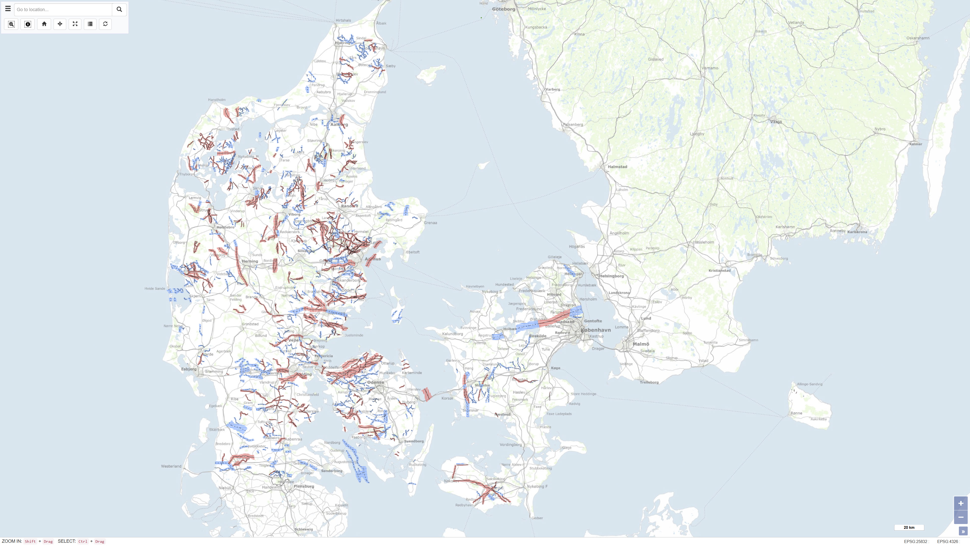
Buried valleys in Denmark
The dataset represents a nationwide mapping of buried valleys in Denmark. The map depicts the occurrence, distribution and general geometry of mapped buried valleys in the Danish subsurface. Buried valleys are elongated depressions in the subsurface that are today fully or partly infilled with younger sediments. In Denmark, the majority of mapped buried valleys are interpreted to have formed during repeated glaciations in the Quaternary period. The valleys are typically 0.5–2 km wide and may reach depths of up to approximately 400 m. The dataset is based on interpretation of geophysical data, primarily TEM and SkyTEM surveys, supplemented by seismic data and borehole information. The mapping provides a national overview of buried valleys and forms a key basis for understanding the geological framework of the subsurface.
Simple
Identifikation
- Titel
-
Buried valleys in Denmark
Offentliggørelsestidspunkt
- Dato (Publication)
- 2016-11-01
Ansvarlig myndighed og kontaktoplysninger
- Kontakt vedr. service
-
Organisationsnavn E-mail adresse Rolle The Geological Survey of Denmark and Greenland (GEUS)
Point of contact
- Metadata author
-
Organisationsnavn E-mail adresse Rolle The Geological Survey of Denmark and Greenland (GEUS)
Point of contact
Geografisk udstrækning
- Koordinatsystem
-
ETRS 89 / UTM 32N (EPSG:25832)
Nøgleord
- Nøgleord
-
Dataset
- Nøgleord
-
Quaternary geology
- Nøgleord
-
Subsurface
- Nøgleord
-
Groundwater
- Type
- Theme
- Nøgleord
- Quaternary geology
- Type
- Theme
- Titel
- Forskningsemner
- Dato (Publication)
- 2025-11-03
- Nøgleord
- Denmark
- Type
- Place
- Titel
- Geografisk
- Dato (Publication)
- 2025-12-11
Kvalitet
- Type som metadata beskriver
- Dataset
- Beskrivelse
-
The dataset was compiled by the Geological Survey of Denmark and Greenland (GEUS) and is based on systematic interpretation of geophysical data collected through national and regional mapping programmes. The mapping was updated and compiled during the period 2010–2015 and is based on TEM and SkyTEM surveys, borehole data from the Jupiter database, and existing geological maps and investigations. The results are documented in the report series Mapping of buried valleys in Denmark, and the present dataset represents the consolidated nationwide interpretation.
)))
