 geodata-info
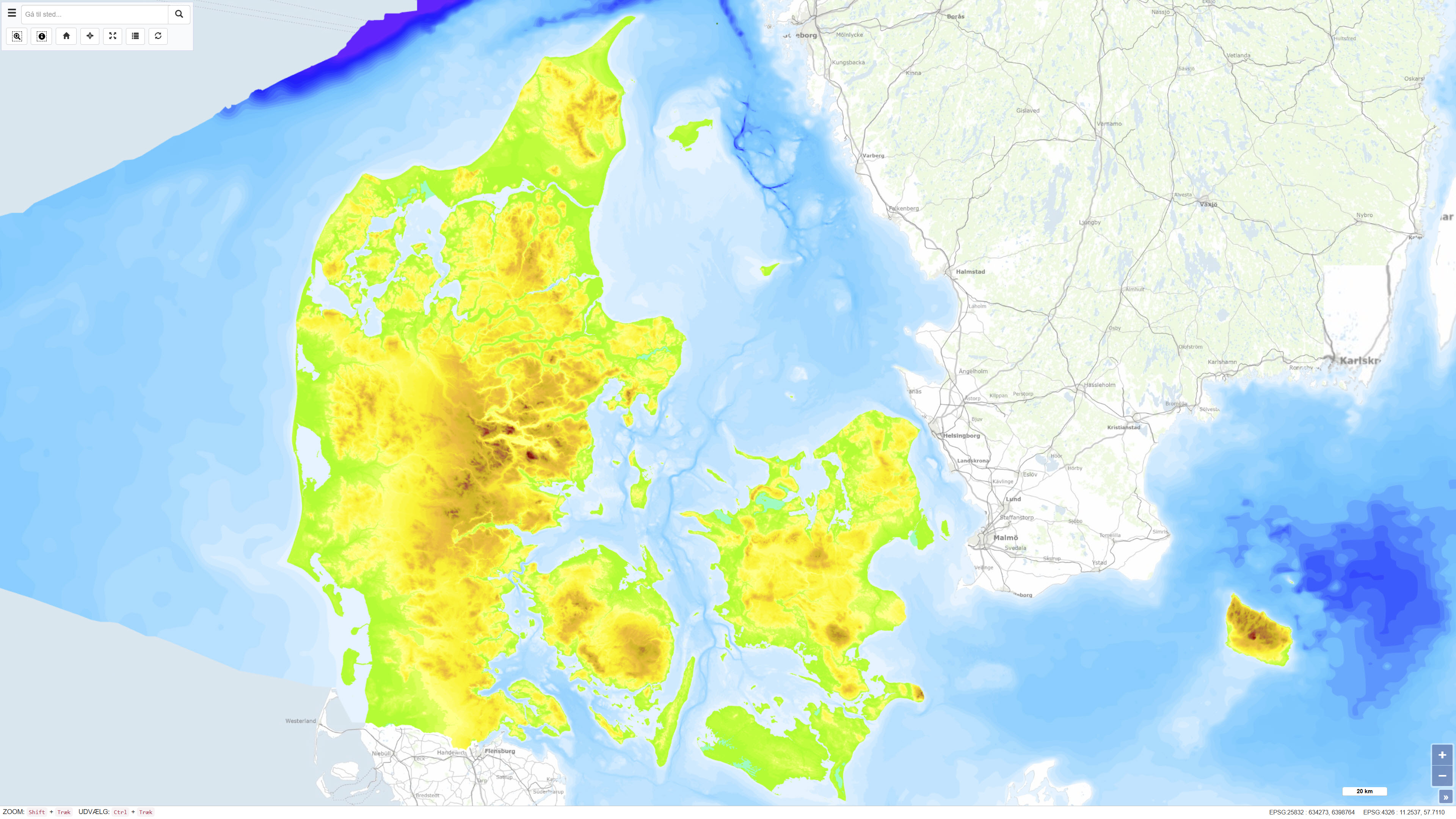
Height and Depth Map of Denmark
The Height and Depth Map of Denmark is a coherent map showing both land elevation above sea level and sea depth within the Danish area. The map is based on elevation and bathymetric data represented by 5-metre contour intervals closed to polygons and provides continuous coverage across the land–sea boundary. The dataset offers an integrated overview of terrain and bathymetry in Denmark and surrounding waters.
The terrestrial elevation component is derived from topographic data suitable for use at scales down to approximately 1:25.000, while the bathymetric component is compiled from datasets of varying origin and resolution. The map was originally assembled around 1997, with subsequent updates to the Danish land areas carried out during 2005–2006. The dataset is primarily intended for regional visualisation and analysis.
Simple
Identifikation
- Titel
-
Height and Depth Map of Denmark
Offentliggørelsestidspunkt
- Dato (Publication)
- 1997-01-01
Ansvarlig myndighed og kontaktoplysninger
- Kontakt vedr. service
-
Organisationsnavn E-mail adresse Rolle The Geological Survey of Denmark and Greenland (GEUS)
Point of contact
- Metadata author
-
Organisationsnavn E-mail adresse Rolle The Geological Survey of Denmark and Greenland (GEUS)
Point of contact
Geografisk udstrækning
- Koordinatsystem
-
ETRS 89 / UTM 32N (EPSG:25832)
Nøgleord
- Nøgleord
-
Dataset
- Nøgleord
-
Elevation
- Nøgleord
-
Bathymetry
- Nøgleord
-
Terrain model
- Nøgleord
-
Denmark
- Nøgleord
-
ArcGIS
- Type
- Theme
- Nøgleord
- Tectonics and structural geology
- Nøgleord
- Geoscience and history policy
- Nøgleord
- Quaternary geology
- Type
- Theme
- Titel
- Forskningsemner
- Dato (Publication)
- 2025-11-03
- Nøgleord
- Denmark
- Type
- Place
- Titel
- Geografisk
- Dato (Publication)
- 2025-12-11
Kvalitet
- Type som metadata beskriver
- Dataset
- Beskrivelse
-
The dataset is compiled from multiple elevation and bathymetric data sources of varying origin and resolution. Terrestrial elevations are based on 5-metre contour lines closed to polygons and later supplemented by a high-resolution elevation grid with a 40 cm resolution produced in 2014–2015 as a mosaic. The bathymetric component is based on 5-metre depth contours from 2006, supplemented by later bathymetric grids.
Depth data originate from several sources depending on geographic area, including the Danish Hydrographic Office for inner Danish waters, the Norwegian Mapping Authority for areas north and west of Frederikshavn, the Baltic Sea Research Institute for southeastern areas towards the Swedish coast, and GEUS data for the North Sea. Bathymetric grids were originally delivered in geographic coordinates and later reprojected to ETRS 1989 / UTM zone 32. The dataset also includes a polygon layer documenting data sources and compilation scale for individual areas.
)))
