 geodata-info
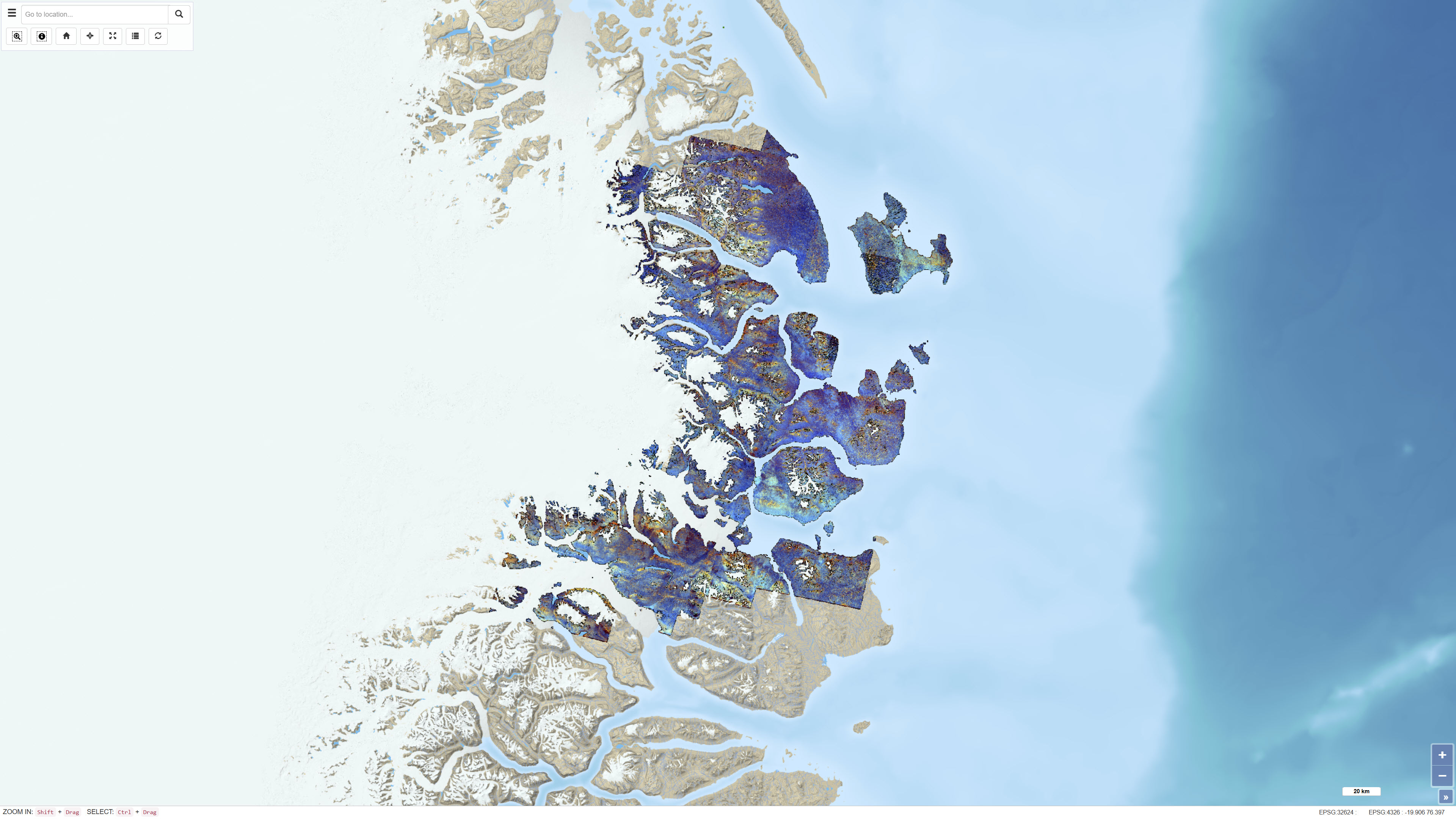
ASTER band ratio data for Northeast Greenland
The dataset consists of a series of ASTER band ratios combined into colour composite images designed to highlight mineralogical distributions and lithological variability in Northeast Greenland. The ASTER scenes were preprocessed with atmospheric, radiometric and topographic corrections, including radiative transfer modelling using ATCOR-3 in rugged terrain mode. A surface elevation model was applied to adjust illumination effects. Non-outcrop pixels were masked prior to generating the final mosaic. Calibrated radiance data were converted to apparent surface reflectance; however, further calibration against ground-based reflectance measurements was not feasible. The dataset represents a derived remote sensing product and not primary satellite data.
Simple
Identifikation
- Titel
-
ASTER band ratio data for Northeast Greenland
Offentliggørelsestidspunkt
- Dato (Publication)
- 2019-05-02
Ansvarlig myndighed og kontaktoplysninger
- Kontakt vedr. service
-
Organisationsnavn E-mail adresse Rolle The Geological Survey of Denmark and Greenland (GEUS)
Point of contact The Geological Survey of Denmark and Greenland (GEUS)
Distributor The Geological Survey of Denmark and Greenland (GEUS)
Point of contact
- Metadata author
-
Organisationsnavn E-mail adresse Rolle The Geological Survey of Denmark and Greenland (GEUS)
Point of contact
Geografisk udstrækning
- Koordinatsystem
-
WGS 84 / UTM 24N (EPSG:32624)
Nøgleord
- Nøgleord
-
Dataset
- Nøgleord
-
ASTER
- Nøgleord
-
Remote sensing
- Nøgleord
-
Band ratios
- Nøgleord
-
Mineral exploration
- Nøgleord
-
Northeast Greenland
- Type
- Theme
- Nøgleord
- Economic geology
- Type
- Theme
- Titel
- Forskningsemner
- Dato (Publication)
- 2025-11-03
- Nøgleord
- Greenland
- Type
- Place
- Titel
- Geografisk
- Dato (Publication)
- 2025-12-11
Kvalitet
- Type som metadata beskriver
- Dataset
- Beskrivelse
-
The dataset is based on ASTER satellite data that were preprocessed using atmospheric, radiometric and topographic corrections. The corrections were performed using ATCOR-3 in rugged terrain mode, applying a digital elevation model to adjust illumination conditions in rugged terrain. The corrected radiance data were converted to apparent surface reflectance. Further calibration against ground-based reflectance measurements was not feasible due to the lack of field data. After correction, non-outcrop pixels were masked and individual scenes were mosaicked. The dataset consists of derived band ratio products and is not identical to the original ASTER Level-1 data.
The source data consist of ASTER Level 1 Precision Terrain Corrected Registered At-Sensor Radiance (AST_L1T) scenes obtained from the USGS EarthExplorer portal. The scenes cover the period 2000–2007 and were limited to summer acquisitions captured during daytime.
)))
