 geodata-info
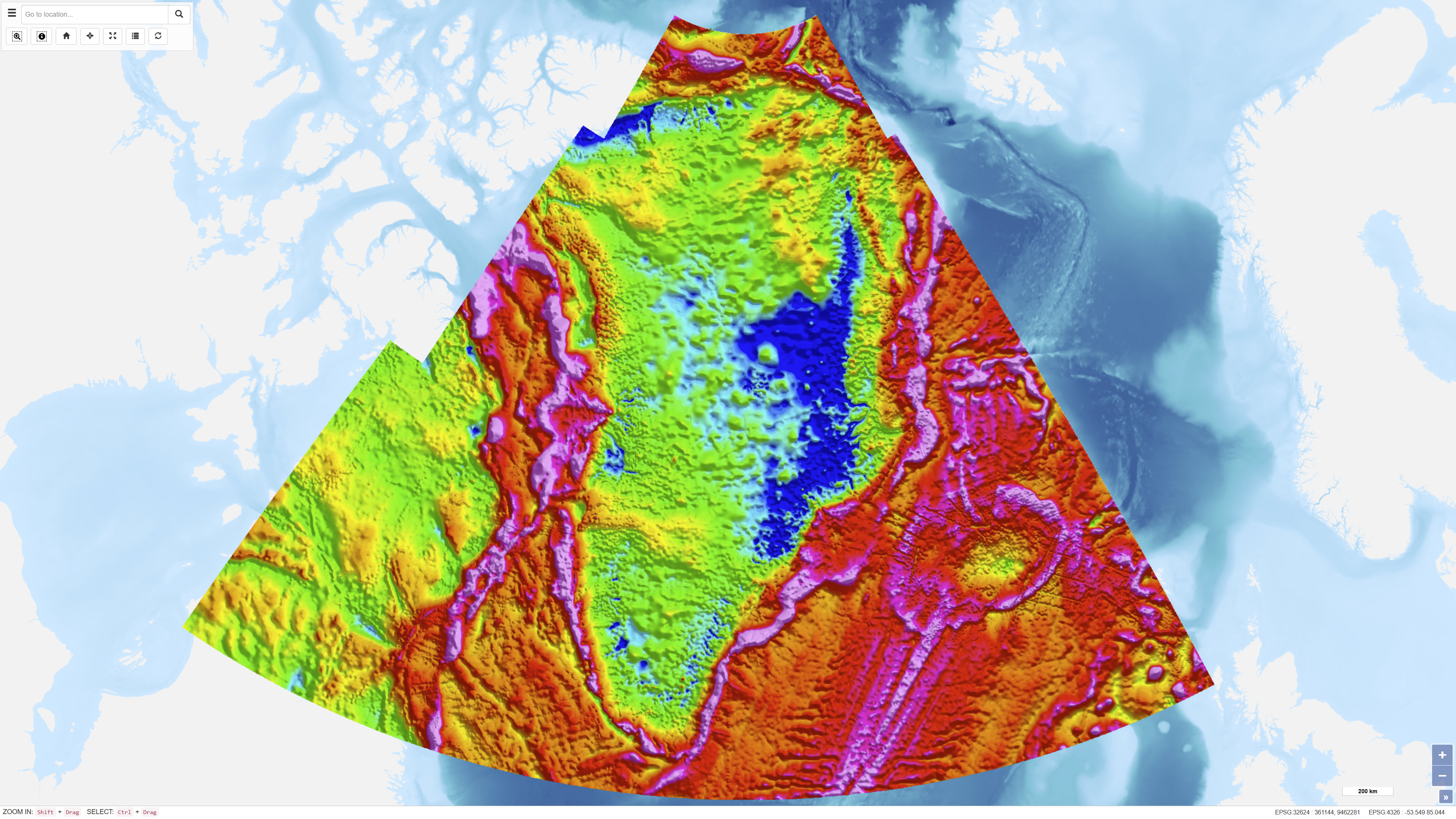
DTU gravity compilation
The dataset represents a regional compilation of terrestrial, marine, airborne and satellite-derived gravity data for Greenland, prepared by DTU Space. The compilation includes calculation of free-air (Faye) and terrain-corrected Bouguer anomalies based on homogenised gravity observations. In areas lacking direct measurements, satellite-derived gravity models have been applied as supplementary data. Over the Greenland Ice Sheet, Bouguer anomalies are calculated using an ice thickness model based on Bamber et al. (2013). The dataset provides a regional gravity framework for geological and geophysical interpretation.
Simple
Identifikation
- Titel
-
DTU gravity compilation
Offentliggørelsestidspunkt
- Dato (Publication)
- 2022-01-01
Ansvarlig myndighed og kontaktoplysninger
- Kontakt vedr. service
-
Organisationsnavn E-mail adresse Rolle The Geological Survey of Denmark and Greenland (GEUS)
Point of contact
- Metadata author
-
Organisationsnavn E-mail adresse Rolle The Geological Survey of Denmark and Greenland (GEUS)
Point of contact
Geografisk udstrækning
- Koordinatsystem
-
WGS 84 / UTM 24N (EPSG:32624)
Nøgleord
- Nøgleord
-
Dataset
- Nøgleord
-
Geophysics
- Nøgleord
-
Gravity
- Nøgleord
-
Bouguer Anomaly
- Nøgleord
-
Free-air Anomaly
- Nøgleord
-
DTU Space
- Nøgleord
-
Greenland
- Type
- Theme
- Nøgleord
- Tectonics and structural geology
- Nøgleord
- Energy and resources
- Type
- Theme
- Titel
- Forskningsemner
- Dato (Publication)
- 2025-11-03
- Nøgleord
- Greenland
- Type
- Place
- Titel
- Geografisk
- Dato (Publication)
- 2025-12-11
Kvalitet
- Type som metadata beskriver
- Dataset
- Beskrivelse
-
The dataset has been established as a compilation of terrestrial, marine, airborne and satellite-derived gravity observations maintained by DTU Space. Data have been homogenised and adjusted to a common reference framework prior to calculation of free-air and Bouguer anomalies. Terrain corrections are based on digital elevation models. Over the Greenland Ice Sheet, ice thickness information is derived from the model presented by Bamber et al. (2013), which integrates radar and satellite data to determine ice thickness and bed topography. In areas without direct gravity observations, satellite-derived gravity models are used as supplementary input.
)))
