 geodata-info
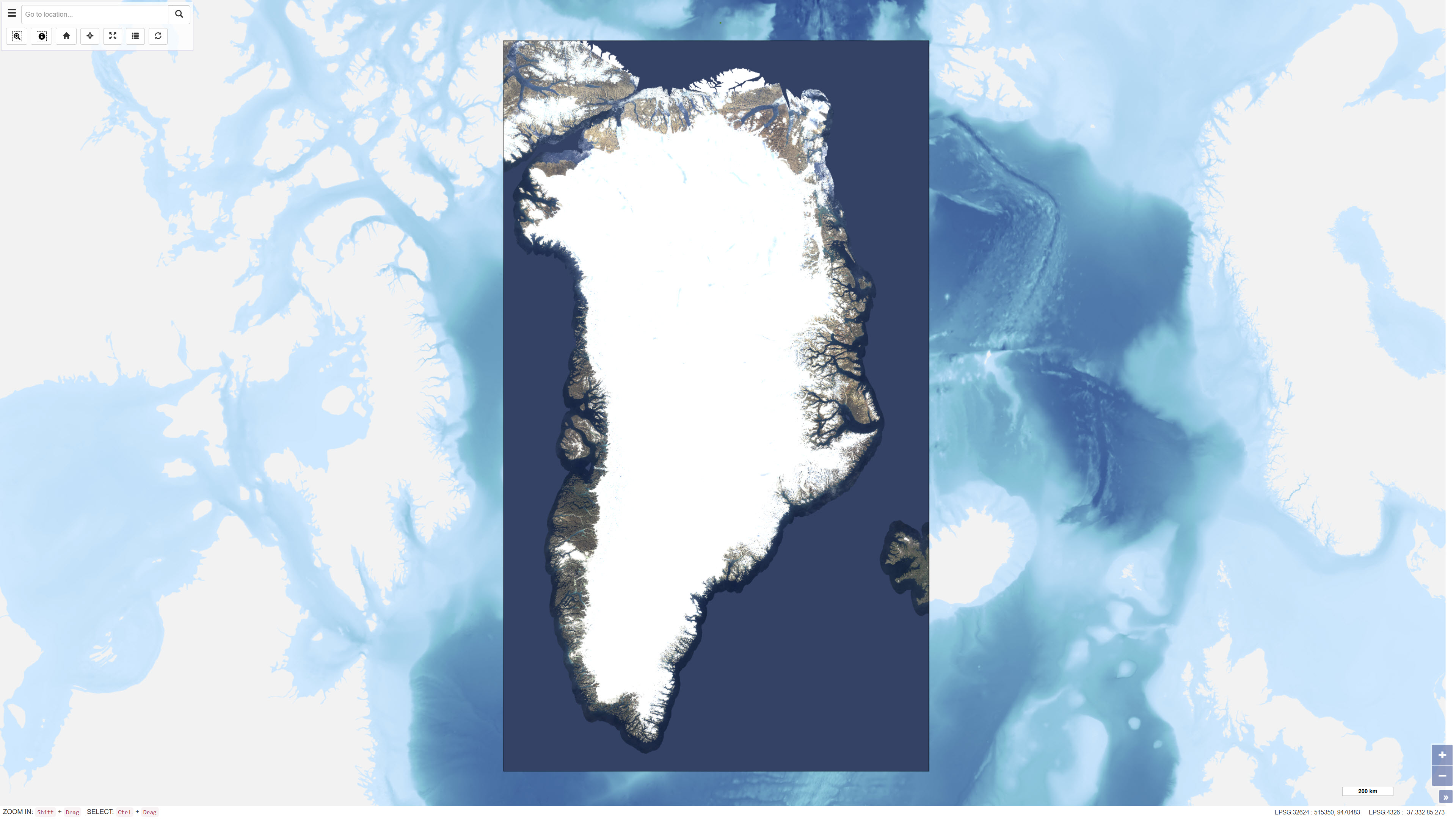
EOX Sentinel-2 Cloudless satellitbilleder af Grønland
EOX Sentinel-2 Cloudless satellite images of Greenland
EOxCloudless er et globalt satellitbaseret billeddatasæt bestående af næsten skyfri mosaikker, der er produceret på baggrund af Copernicus Sentinel-2 multispektrale satellitdata. Datasættet er udviklet af EOX IT Services GmbH og er designet til at levere ensartede, højopløselige overfladebilleder til brug inden for kortlægning, analyse og visualisering.
Mosaikkerne er skabt ved at kombinere et stort antal Sentinel-2 Level-1C observationer over udvalgte tidsperioder, hvor avancerede pixel-udvælgelsesmetoder og maskeringer (bl.a. skyer, skygger og vand) anvendes for at minimere forekomsten af skydække. For hvert pixel vælges den mest repræsentative observation baseret på statistiske kriterier og tidsserier, hvilket resulterer i næsten skyfri billeder.
Datasættet dækker globale landområder og leveres typisk med en rumlig opløsning på 10 meter for de anvendte spektralbånd (blå, grøn, rød og nær-infrarød). EOxCloudless kan anvendes som baggrundskort, til miljøovervågning, arealanalyse, rumlig planlægning og andre geovidenskabelige formål.
EOxCloudless is a global satellite imagery dataset consisting of near-cloudless mosaics derived from Copernicus Sentinel-2 multispectral satellite data. The dataset is produced by EOX IT Services GmbH and is designed to provide consistent, high-resolution surface imagery for mapping, analysis, and visualization purposes.
The mosaics are generated by combining a large number of Sentinel-2 Level-1C observations acquired over defined time periods. Advanced pixel selection algorithms and thematic masks (including clouds, cloud shadows, and water) are applied to reduce cloud contamination. For each pixel location, the most representative observation is selected based on statistical criteria and temporal analysis, resulting in near-cloudless composite images.
The dataset provides global land coverage and is typically delivered at a spatial resolution of 10 metres for the utilised spectral bands (blue, green, red, and near-infrared). EOxCloudless is suitable for use as a basemap as well as for environmental monitoring, land analysis, spatial planning, and other geoscientific applications.
Simple
Identifikation
- Titel
-
EOX Sentinel-2 Cloudless satellitbilleder af Grønland
EOX Sentinel-2 Cloudless satellite images of Greenland
Offentliggørelsestidspunkt
-
Dato (Publication)Dato (Publication)
- 2018-08-01
Ansvarlig myndighed og kontaktoplysninger
- Kontakt vedr. service
-
Organisationsnavn E-mail adresse Rolle De Nationale Geologiske Undersøgelser for Danmark og Grønland (GEUS)
The Geological Survey of Denmark and Greenland (GEUS)
Point of contactPoint of contact
- Metadata author
-
Organisationsnavn E-mail adresse Rolle De Nationale Geologiske Undersøgelser for Danmark og Grønland (GEUS)
The Geological Survey of Denmark and Greenland (GEUS)
Point of contactPoint of contact
Geografisk udstrækning
- Koordinatsystem
-
WGS 84 / UTM 24N (EPSG:32624)
WGS 84 / UTM 24N (EPSG:32624)
Nøgleord
-
NøgleordNøgleord
-
Datasæt
Dataset
-
NøgleordNøgleord
-
Satellit
Satellite
-
NøgleordNøgleord
-
Grønland
Greenland
-
NøgleordNøgleord
-
Sentinel-2
Sentinel-2
-
TypeType
-
ThemeTheme
-
NøgleordNøgleord
-
Geovidenskab og historiepolitikGeoscience and history policy
-
TypeType
-
ThemeTheme
-
Titel
-
Forskningsemner
-
Dato (Publication)Dato (Publication)
- 2025-11-03
-
NøgleordNøgleord
-
GrønlandGreenland
-
TypeType
-
PlacePlace
-
Titel
-
Geografisk
-
Dato (Publication)Dato (Publication)
- 2025-12-11
Kvalitet
-
Type som metadata beskriverType som metadata beskriver
-
DatasetDataset
-
BeskrivelseBeskrivelse
-
EOX Sentinel-2 cloudless er et datasæt købt fra virksomheden EOX, der indeholder en mosaik af skyfrie satellitbilleder fra hele verden i en skala fra 1:20.000. Det originale datasæt består af en GeoPackage med fliser på 512 x 512 pixels med LZW (lossless) komprimering, hvor de individuelle fliser er gemt som GeoTIFF'er med 8-bit RGB-bånd, hver i et ikke-projiceret geografisk koordinatsystem WGS 84 (EPSG: 4326). Datasættet er kun klippet til Grønland og projiceret fra WGS 84 til projekteret koordinatsystem WGS 84 / UTM 24N (EPSG: 32624).
EOX Sentinel-2 cloudless is a purchased dataset from the company EOX that contains a mosaic of cloudless satellite imagery worldwide on a scale of 1:20.000. The original dataset consists of a GeoPackage with tiles of 512 x 512 pixels with LZW (lossless) compression where the individual tiles are stored as GeoTIFFs with 8-bit RGB bands, each in a non-projected geographical coordinate system (WGS 84, EPSG: 4326). The data set is cut to Greenland only and projected from WGS 84 to projected coordinate system WGS 84 / UTM 24N (EPSG: 32624).
)))
