 geodata-info
DK model 2019 – Model data
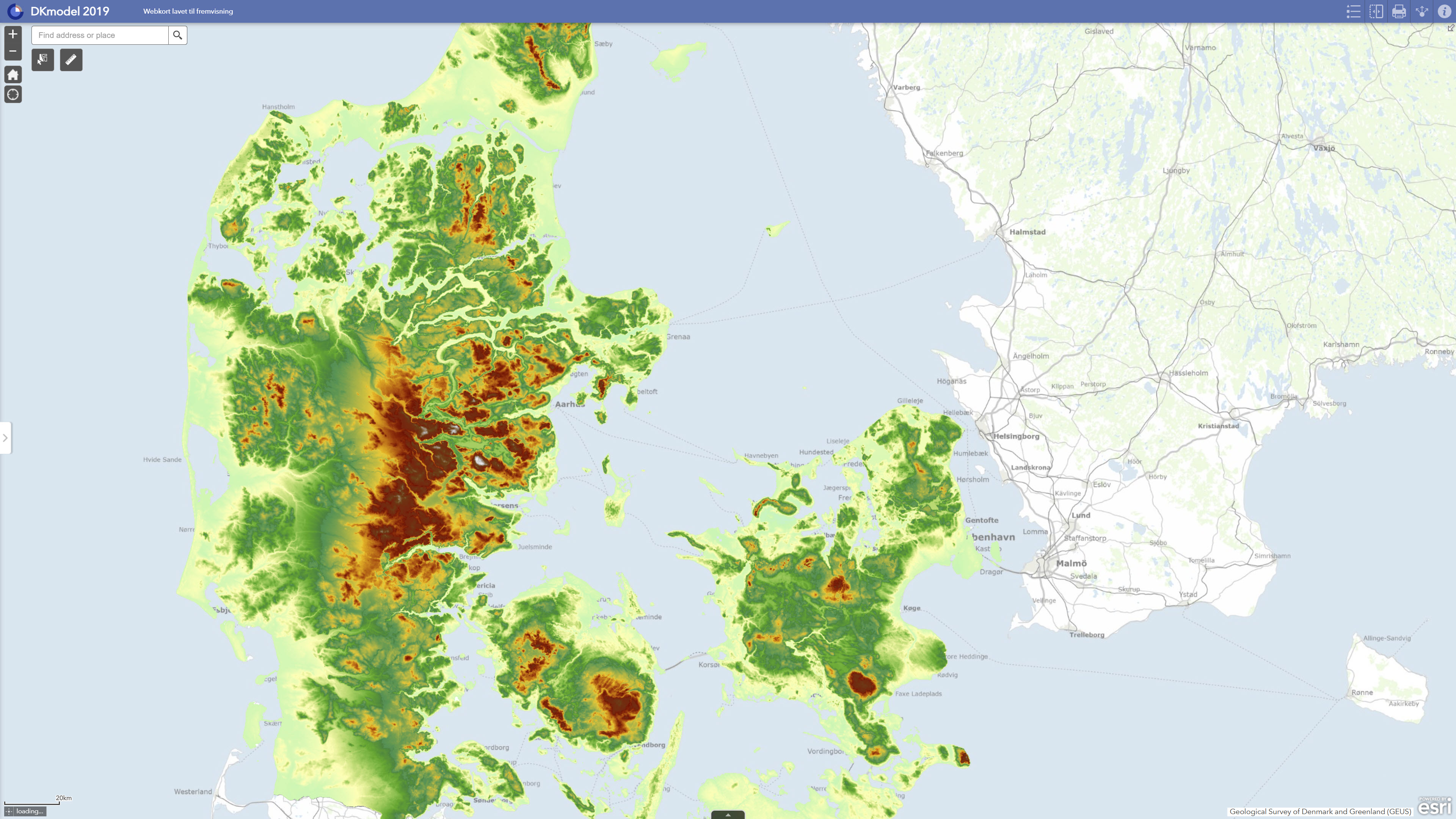
DK model 2019 – Model data comprises core model data from GEUS’ national hydrological model for Denmark. The dataset describes the model basis used in DK model 2019, including the hydrogeological model structure, computational grid, groundwater bodies, climate input, water abstraction data, stream network and other thematic input data included in the model setup. DK model 2019 was updated with new groundwater bodies, new hydrogeological mapping information and a new calibration against observed groundwater heads and stream discharge. The model data form the basis for calculations of groundwater recharge, water balance, water abstraction, drawdown, exploitation rates and impacts on streams. The dataset is suitable as documentation of the model basis and as input to regional analyses, screening and further modelling studies, but should not be used directly for local-scale issues without a separate assessment.
Simple
Identifikation
- Titel
-
DK model 2019 – Model data
Offentliggørelsestidspunkt
- Dato (Publication)
- 2022-08-25
Ansvarlig myndighed og kontaktoplysninger
- Kontakt vedr. service
-
Organisationsnavn E-mail adresse Rolle The Geological Survey of Denmark and Greenland (GEUS)
Point of contact
- Metadata author
-
Organisationsnavn E-mail adresse Rolle The Geological Survey of Denmark and Greenland (GEUS)
Point of contact
Geografisk udstrækning
- Koordinatsystem
-
ETRS 89 / UTM 32N (EPSG:25832)
Nøgleord
- Nøgleord
-
Dataset
- Nøgleord
-
Hydrological model
- Nøgleord
-
Model data
- Nøgleord
-
Groundwater
- Nøgleord
-
Water balance
- Nøgleord
-
Hydrogeology
- Nøgleord
-
DK model 2019
- Type
- Theme
- Nøgleord
- Hydrology
- Type
- Theme
- Titel
- Forskningsemner
- Dato (Publication)
- 2025-11-03
- Nøgleord
- Denmark
- Type
- Place
- Titel
- Geografisk
- Dato (Publication)
- 2025-12-11
Kvalitet
- Type som metadata beskriver
- Dataset
- Beskrivelse
-
The model data were established as part of DK model 2019, GEUS’ national hydrological model for Denmark. The model setup is based on a hydrogeological interpretation model including aquifer layers, clay layers and pre-Quaternary units. For Jutland, the model is based on the FOHM compilations, while Funen, Zealand and the islands are based on DK model 2014 with subsequent integration of hydrogeological mapping models up to and including 2018. For Bornholm, the hydrogeological model is based on earlier DK model data. The model includes Quaternary sand layers, pre-Quaternary sand layers, chalk and regional hydrostratigraphic units. Climate input consists of daily values for dynamically corrected precipitation, reference evapotranspiration and temperature based on DMI climate grids. Water abstraction data were extracted from the national borehole database JUPITER and incorporated at waterworks, borehole and intake level, with abstractions distributed in the model according to the available information. The model data were used as the basis for dynamic model runs, calibration, validation and subsequent calculations of water balance, groundwater recharge, exploitation rates, drawdown and streamflow impacts.
)))
