 geodata-info
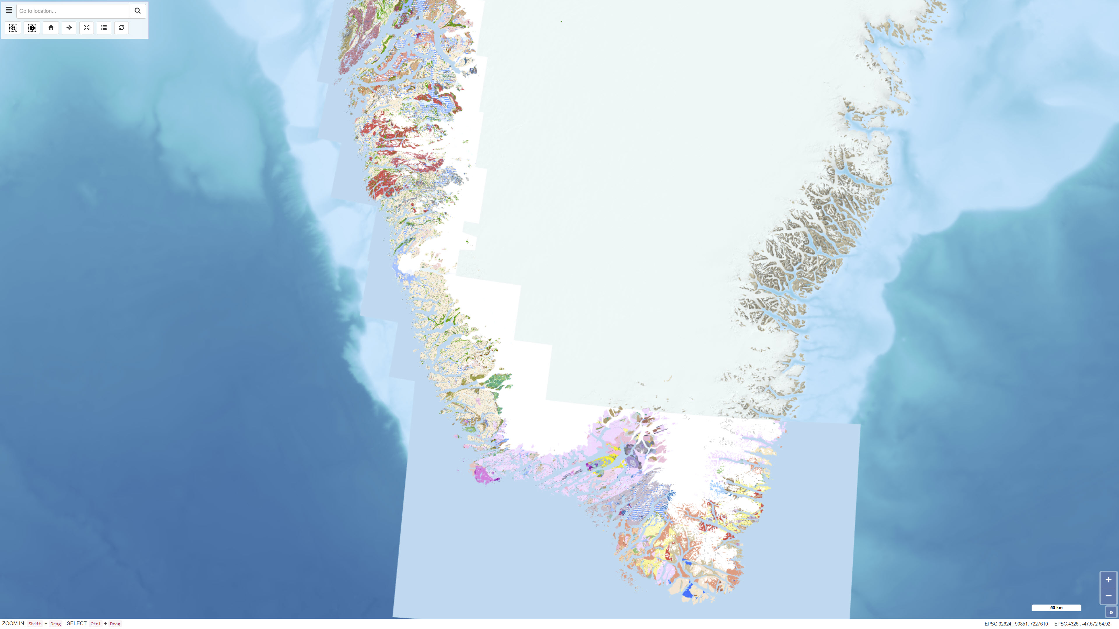
Geological map of South and South-West Greenland 1:100.000
The seamless digital geological map is based on the digitisation and harmonisation of 21 geological map sheets at 1:100 000 scale, originally published by GGU/GEUS between 1966 and 2011. This edition updates and expands the 2019 version, which included 16 sheets, by integrating five additional 1:100 000 sheets and selected information from 1:500 000 scale maps in areas lacking detailed coverage. The map also incorporates a simplified geological interpretation of Bjørneøen and Storeø in Godthåbsfjorden based on detailed mapping by Claus Østergaard (2005). The dataset provides a consistent, seamless geological framework optimised for digital display at the 1:100 000 scale.
Simple
Identifikation
- Titel
-
Geological map of South and South-West Greenland 1:100.000
Offentliggørelsestidspunkt
- Dato (Publication)
- 2025-11-18
Ansvarlig myndighed og kontaktoplysninger
- Kontakt vedr. service
-
Organisationsnavn E-mail adresse Rolle The Geological Survey of Denmark and Greenland (GEUS)
Point of contact
- Metadata author
-
Organisationsnavn E-mail adresse Rolle The Geological Survey of Denmark and Greenland (GEUS)
Point of contact
Geografisk udstrækning
- Koordinatsystem
-
WGS 84 / UTM 24N (EPSG:32624)
Nøgleord
- Nøgleord
-
Dataset
- Nøgleord
-
Geology
- Nøgleord
-
Greenland
- Nøgleord
-
Mapping
- Nøgleord
-
Stratigraphy
- Nøgleord
-
Geodata
- Nøgleord
-
ArcGIS
- Nøgleord
-
QGIS
- Type
- Theme
- Nøgleord
- Tectonics and structural geology
- Nøgleord
- Stratigraphy and correlation
- Nøgleord
- Energy and resources
- Type
- Theme
- Titel
- Forskningsemner
- Dato (Publication)
- 2025-11-03
- Nøgleord
- Greenland
- Type
- Place
- Titel
- Geografisk
- Dato (Publication)
- 2025-12-11
Kvalitet
- Type som metadata beskriver
- Dataset
- Beskrivelse
-
The dataset is the result of a continued effort to digitize and homogenize map sheets dating from the sixties to the nineties, made by different geologists.
)))
