 geodata-info
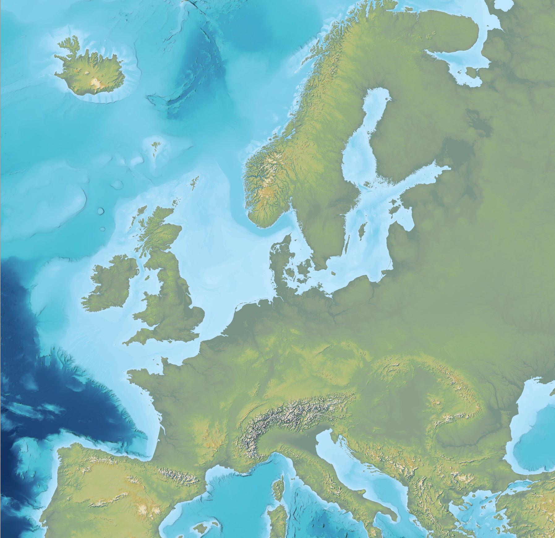
Topography and bathymetry of Europe
The dataset is an Imhof-inspired cartographic base map combining topography and bathymetry, covering European countries and adjacent marine areas. The map has been constructed by merging several existing digital elevation models, with topography primarily based on EU-DEM v1.1 and the Shuttle Radar Topography Mission (SRTM), and bathymetry derived from the General Bathymetric Chart of the Oceans (GEBCO). The dataset provides a continuous surface integrating land and marine areas and has been developed with a focus on visual quality and regional applications.
Simple
Identifikation
- Titel
-
Topography and bathymetry of Europe
Offentliggørelsestidspunkt
- Dato (Publication)
- 2023-10-05
Ansvarlig myndighed og kontaktoplysninger
- Kontakt vedr. service
-
Organisationsnavn E-mail adresse Rolle The Geological Survey of Denmark and Greenland (GEUS)
Point of contact
- Metadata author
-
Organisationsnavn E-mail adresse Rolle The Geological Survey of Denmark and Greenland (GEUS)
Point of contact
Geografisk udstrækning
- Koordinatsystem
-
ETRS 89 / UTM 32N (EPSG:25832)
Nøgleord
- Nøgleord
-
Dataset
- Nøgleord
-
Digital elevation model
- Nøgleord
-
Topography
- Nøgleord
-
Bathymetry
- Nøgleord
-
Composite dataset
- Nøgleord
-
Terrain model
- Nøgleord
-
GEBCO
- Type
- Theme
- Nøgleord
- Geoscience and history policy
- Type
- Theme
- Titel
- Forskningsemner
- Dato (Publication)
- 2025-11-03
- Nøgleord
- Denmark
- Nøgleord
- Europe
- Type
- Place
- Titel
- Geografisk
- Dato (Publication)
- 2025-12-11
Kvalitet
- Type som metadata beskriver
- Dataset
- Beskrivelse
-
The dataset was produced by merging several existing digital elevation models. EU-DEM version 1.1 and SRTM DEM were used as primary sources for land areas, while bathymetric data from GEBCO were used for marine areas. The original datasets were harmonised with respect to resolution, reference system and spatial coverage to produce a continuous surface. The dataset is a derived product and reflects the quality, resolution and limitations of the source datasets.
)))
