 geodata-info
Historical Mineral Exploration and Exploitation Licences in Greenland
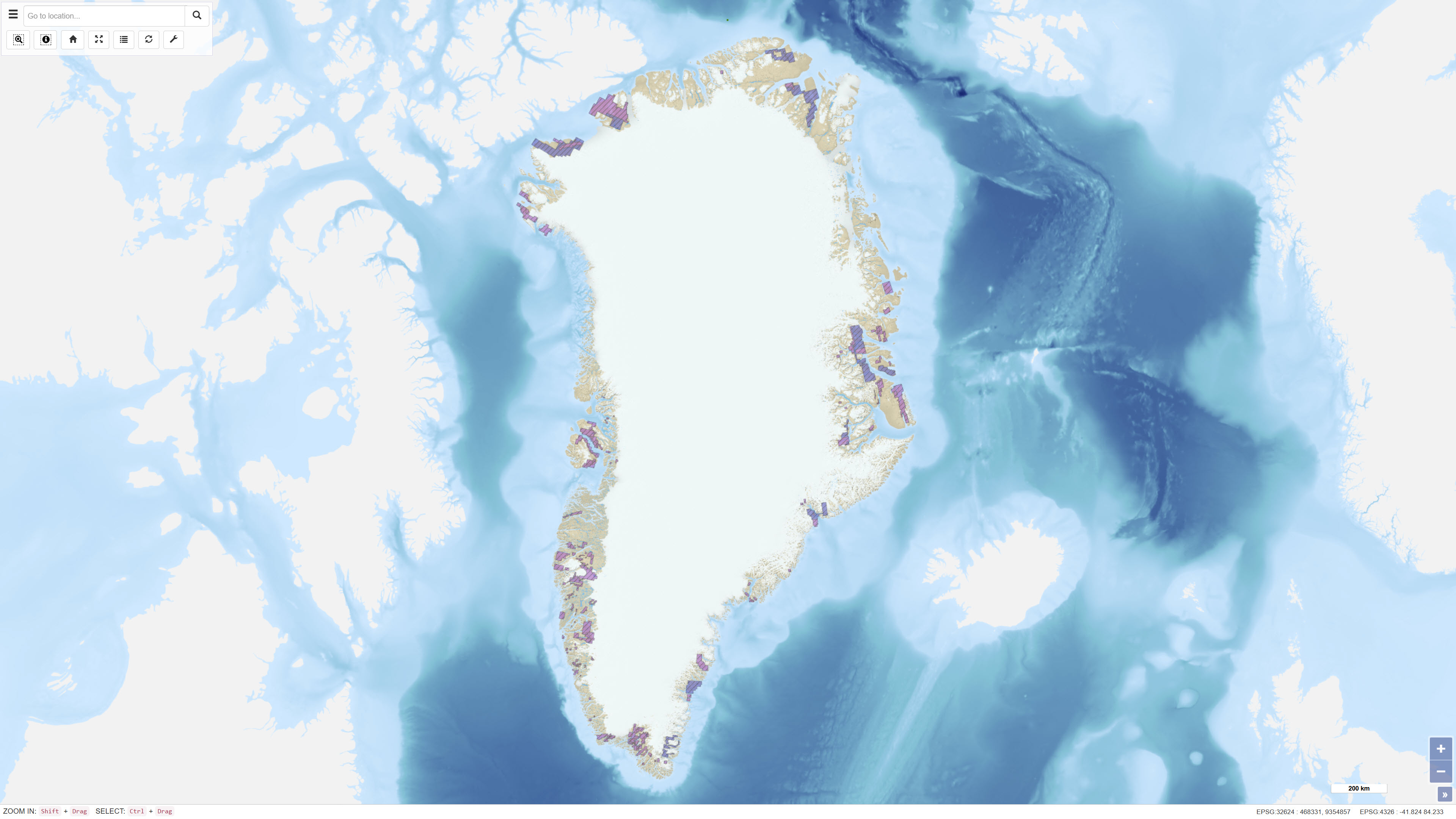
The dataset contains polygons representing historical exploration and exploitation licences for mineral resources in Greenland. The data are based on geographic information provided via WFS by the Ministry of Mineral Resources in Greenland and are redistributed without modification of the original boundaries. The dataset provides an overview of former licence areas and their spatial extent.
Simple
Identifikation
- Titel
-
Historical Mineral Exploration and Exploitation Licences in Greenland
Offentliggørelsestidspunkt
- Dato (Publication)
- 2022-01-01
Ansvarlig myndighed og kontaktoplysninger
- Kontakt vedr. service
-
Organisationsnavn E-mail adresse Rolle The Ministry of Mineral Resources, and the Mineral Licence and Safety Authority
Point of contact
- Metadata author
-
Organisationsnavn E-mail adresse Rolle The Geological Survey of Denmark and Greenland (GEUS)
Point of contact
Geografisk udstrækning
- Koordinatsystem
-
WGS 84 / UTM 24N (EPSG:32624)
Nøgleord
- Nøgleord
-
Dataset
- Nøgleord
-
Mineral Licences
- Nøgleord
-
Historical Licences
- Nøgleord
-
Exploration
- Nøgleord
-
Exploitation
- Nøgleord
-
Administrative Boundaries
- Nøgleord
-
Greenland
- Type
- Theme
- Nøgleord
- Energy and resources
- Type
- Theme
- Titel
- Forskningsemner
- Dato (Publication)
- 2025-11-03
- Nøgleord
- Greenland
- Type
- Place
- Titel
- Geografisk
- Dato (Publication)
- 2025-12-11
Kvalitet
- Type som metadata beskriver
- Dataset
- Beskrivelse
-
The dataset is based on geographic data provided via WFS by the Ministry of Mineral Resources in Greenland. The data are retrieved and converted into GEUS’ internal data structure and redistributed through GEUS’ MapServer setup without modification of the original polygon boundaries. Classification and attribute information follow the structure defined in the source service. The dataset is updated in accordance with changes in the official source service.
)))
