 geodata-info
Vertical aerial photographs of Greenland 1:150.000
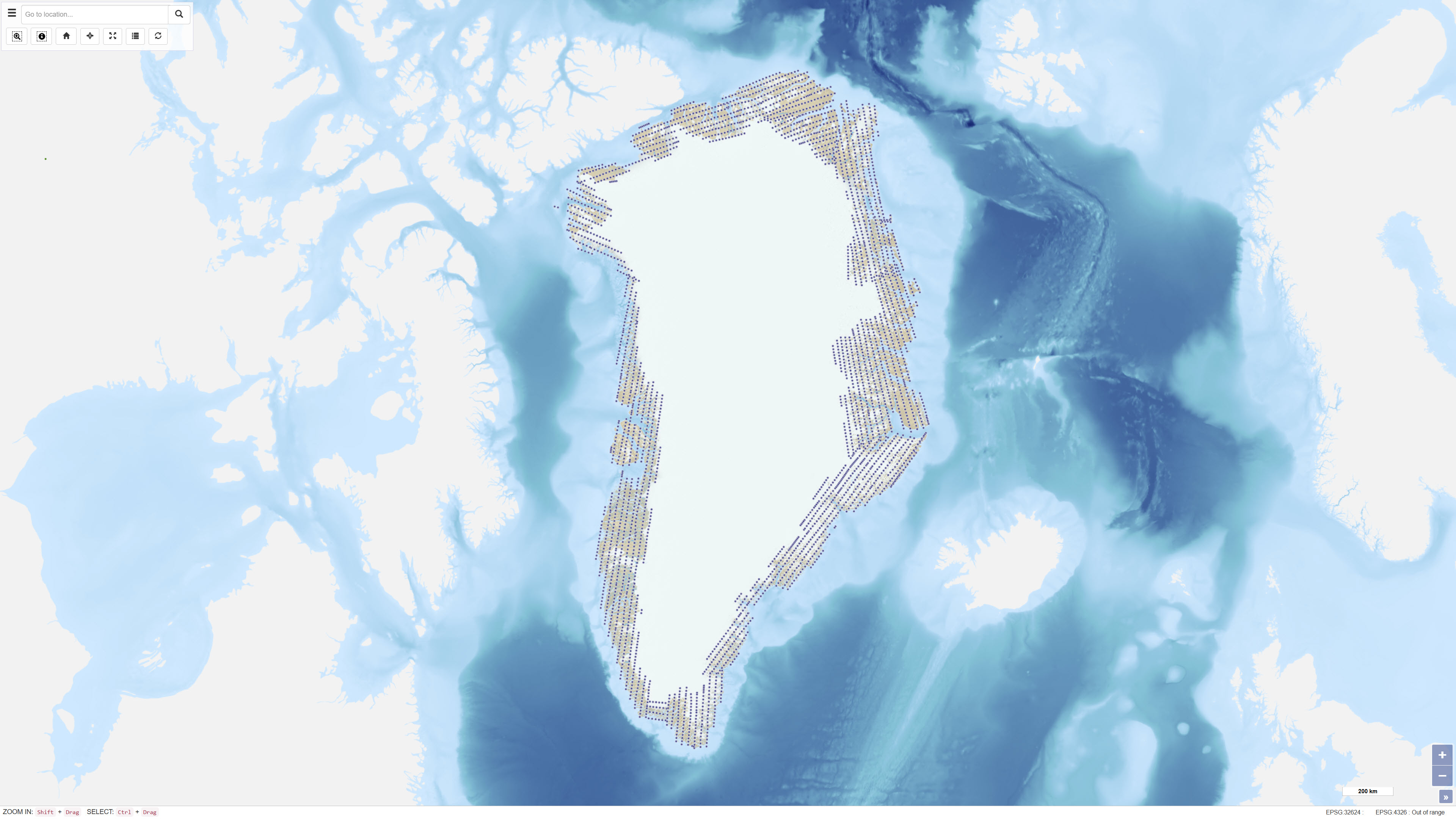
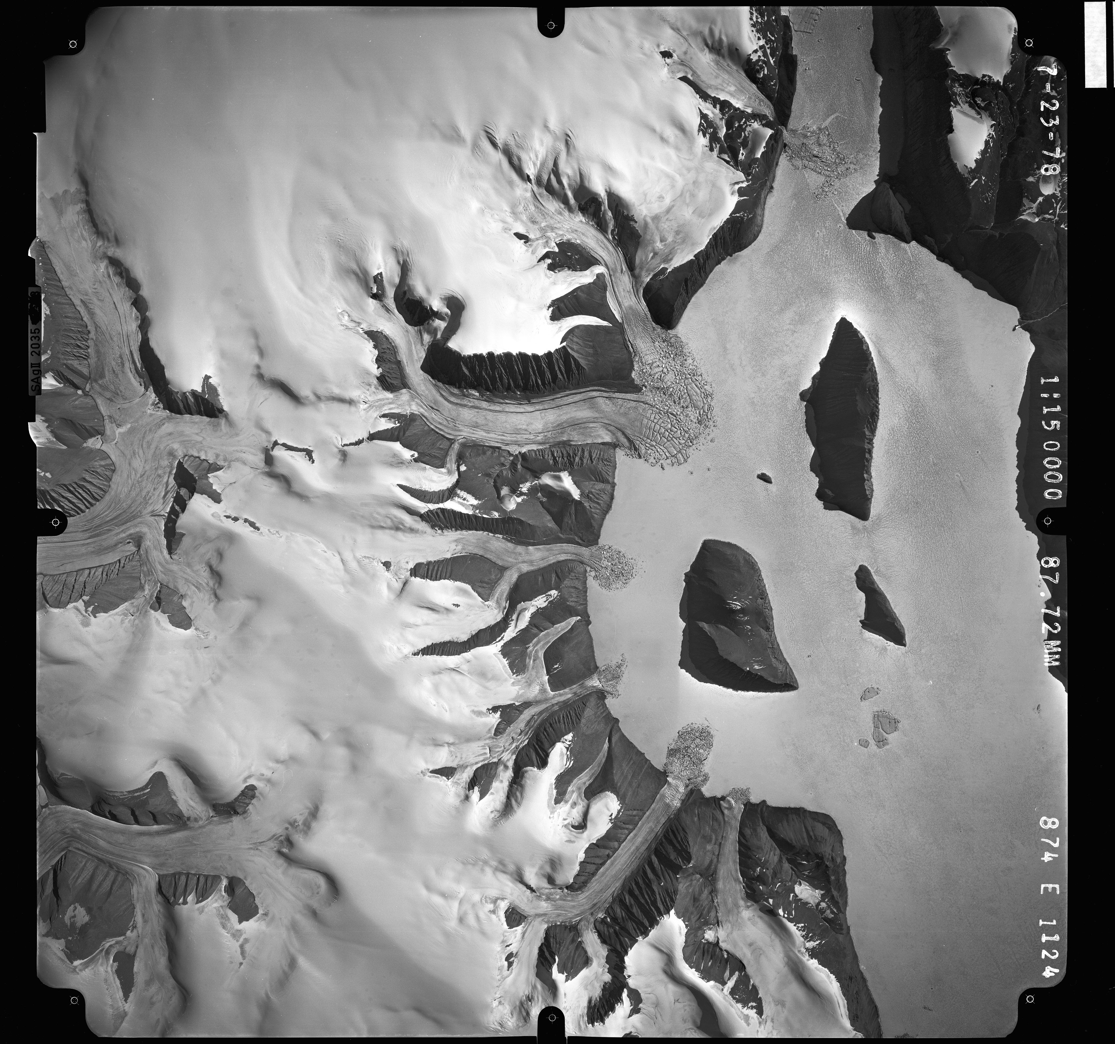
Uniform vertical aerial photographic coverage of Greenland was achieved between 1978 and 1987 at a scale of 1:150.000 by Mark Hurd Aerial Surveys, Inc., Minneapolis, Minnesota, U.S.A., on behalf of the Danish Geodetic Institute. The photography provided systematic nationwide coverage and formed a fundamental reference dataset for mapping and geodetic purposes.
The black-and-white photographs were acquired using a Wild RC-10 camera equipped with a super wide-angle lens (focal length 88 mm). The aircraft used was a Gates Learjet 25C, flying at approximately 14 km altitude to achieve the image scale of 1:150.000. To minimise blind areas caused by steep mountain slopes in combination with the wide-angle lens, photographs were acquired with 80% forward overlap and 40% side overlap.
Photo centre coordinates were established through aerotriangulation performed by the Danish Geodata Agency. The dataset has subsequently been used for mapping, aerotriangulation and scanning applications.
Simple
Identifikation
- Titel
-
Vertical aerial photographs of Greenland 1:150.000
Offentliggørelsestidspunkt
- Dato (Publication)
- 2023-12-03
Ansvarlig myndighed og kontaktoplysninger
- Kontakt vedr. service
-
Organisationsnavn E-mail adresse Rolle The Geological Survey of Denmark and Greenland (GEUS)
Point of contact
- Metadata author
-
Organisationsnavn E-mail adresse Rolle The Geological Survey of Denmark and Greenland (GEUS)
Point of contact
Geografisk udstrækning
- Koordinatsystem
-
WGS 84 / UTM 24N (EPSG:32624)
Nøgleord
- Nøgleord
-
Dataset
- Nøgleord
-
Vertical aerial photographs
- Nøgleord
-
Aerial photography
- Nøgleord
-
Photogrammetry
- Nøgleord
-
Greenland
- Type
- Theme
- Nøgleord
- Geoscience and history policy
- Type
- Theme
- Titel
- Forskningsemner
- Dato (Publication)
- 2025-11-03
- Nøgleord
- Greenland
- Type
- Place
- Titel
- Geografisk
- Dato (Publication)
- 2025-12-11
Kvalitet
- Type som metadata beskriver
- Dataset
- Beskrivelse
-
The aerial photographs were acquired between 1978 and 1987 by Mark Hurd Aerial Surveys, Inc. for the Danish Geodetic Institute as part of a national aerial photography programme. The survey was designed to provide complete photographic coverage of Greenland at a uniform scale of 1:150,000.
The photographs were acquired with systematic forward and side overlap to ensure stereoscopic coverage and minimise blind areas. Subsequent aerotriangulation was performed by the Danish Geodata Agency to establish accurate photo centre coordinates. The dataset has since been used as a basis for mapping, geodetic and geoscientific applications.
)))
