 geodata-info
Terrænnær geofysik i Danmark, Gerda
Surface-near geophysics in Denmark, Gerda
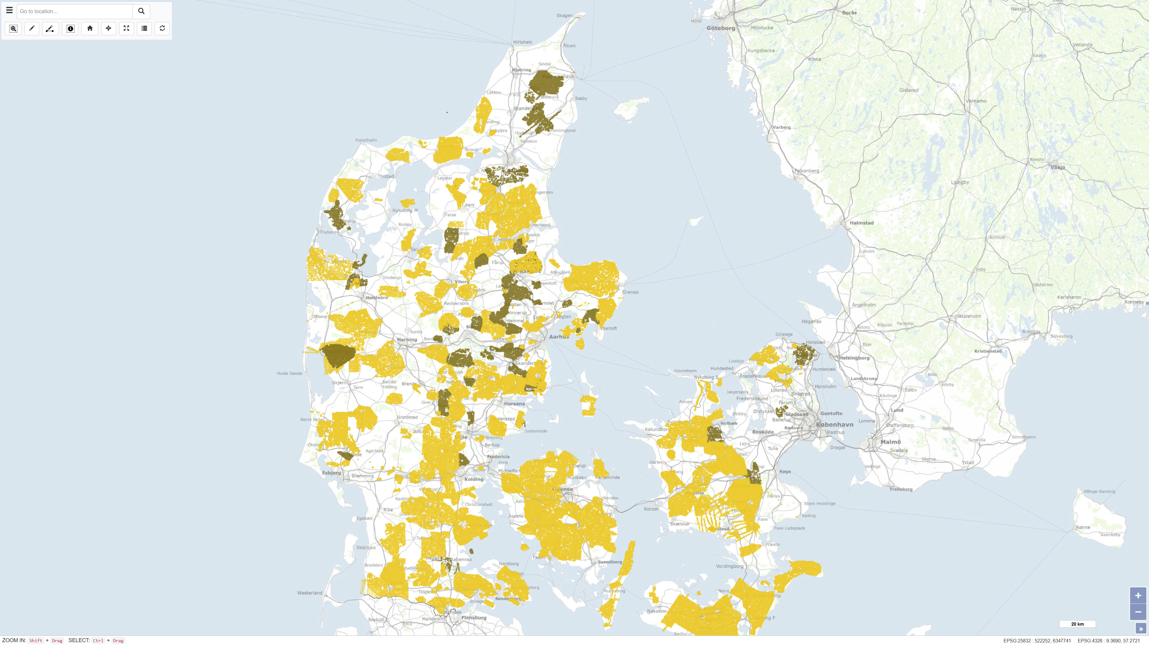
Landsdækkende geofysisk database for miljø- og råstofområdet, også kaldet GERDA (GEofysisk Relationel DAtabase). Databasen indeholder diverse geofysik-typer, herunder geoelektrik, elektromagnetik, borehulslogs og seismik. Alle data er frit tilgængelige for download via GEUS' hjemmeside.
Databasen opdateres løbende.
Nationwide geophysical database for environmental and raw material data, also known as GERDA (GEophysical Relational DAtabase).
The database contains various types of geophysics, including geoelectrics, electromagnetics, borehole logs and seismic. All data is freely available for download on the GEUS website.
The database is updated continuously.
Simple
Identifikation
- Titel
-
Terrænnær geofysik i Danmark, Gerda
Surface-near geophysics in Denmark, Gerda
Offentliggørelsestidspunkt
-
Dato (Publication)Dato (Publication)
- 2023-01-01
Ansvarlig myndighed og kontaktoplysninger
- Kontakt vedr. service
-
Organisationsnavn E-mail adresse Rolle De Nationale Geologiske Undersøgelser for Danmark og Grønland (GEUS)
The Geological Survey of Denmark and Greenland (GEUS)
Point of contactPoint of contact
- Metadata author
-
Organisationsnavn E-mail adresse Rolle De Nationale Geologiske Undersøgelser for Danmark og Grønland (GEUS)
The Geological Survey of Denmark and Greenland (GEUS)
Point of contactPoint of contact
Geografisk udstrækning
- Koordinatsystem
-
ETRS 89 / UTM 32N (EPSG:25832)
ETRS 89 / UTM 32N (EPSG:25832)
Nøgleord
-
NøgleordNøgleord
-
Datasæt
Dataset
-
NøgleordNøgleord
-
Geofysik
Geophysics
-
TypeType
-
ThemeTheme
-
NøgleordNøgleord
-
Beregningsmæssig geovidenskab, informatik og fjernmålingComputational geoscience, informatics and remote sensing
-
TypeType
-
ThemeTheme
-
Titel
-
Forskningsemner
-
Dato (Publication)Dato (Publication)
- 2025-11-03
-
NøgleordNøgleord
-
DanmarkDenmark
-
TypeType
-
PlacePlace
-
Titel
-
Geografisk
-
Dato (Publication)Dato (Publication)
- 2025-12-11
Kvalitet
-
Type som metadata beskriverType som metadata beskriver
-
DatasetDataset
-
BeskrivelseBeskrivelse
-
I et samarbejde mellem Skov- og Naturstyrelsen, Afdelingen for Grundvand og Råstoffer ved det tidligere Århus Amt, Geologisk Institut ved Århus Universitet og GEUS blev der i 1996 til 1997 gennemført et pilotprojekt med det formål at forberede etableringen af en landsdækkende database for geofysiske data inden for råstof- og miljøområderne. Dette arbejde mundede i 1998 ud i etableringen af en database og et tilhørende websted. Udviklingen er sket i et tæt samarbejde mellem Afdelingen for Grundvand og Råstoffer ved det tidligere Århus Amt, Geologisk Institut ved Århus Universitet og de tidligere firmaer Dansk Geofysik A/S, WaterTech A/S og Geografik A/S. Databasen er sidenhen blevet videreudviklet til at omfatte flere geofysiske metoder, ligesom data løbende indberettes i forbindelse med nye undersøgelser. Dataindholdet kvalitetssikres af GEUS.
In cooperation with the then Danish Forest and Nature Agency, the Department Groundwater and Rawmaterials at the then Århus Amt (county), the Geological Institute at Aarhus University and GEUS, a pilot project was carried out in the period 1996 to 1997. The aim of the project was to prepare the establishment of a national database for geophysical data regarding raw material and environment. In 1998, this work resulted in the establishment of a database and an associated website. The database has since been developed to include more geophysical methods, just as data is continuously reported in connection with new studies. The data is quality assured by GEUS.
)))
