 geodata-info
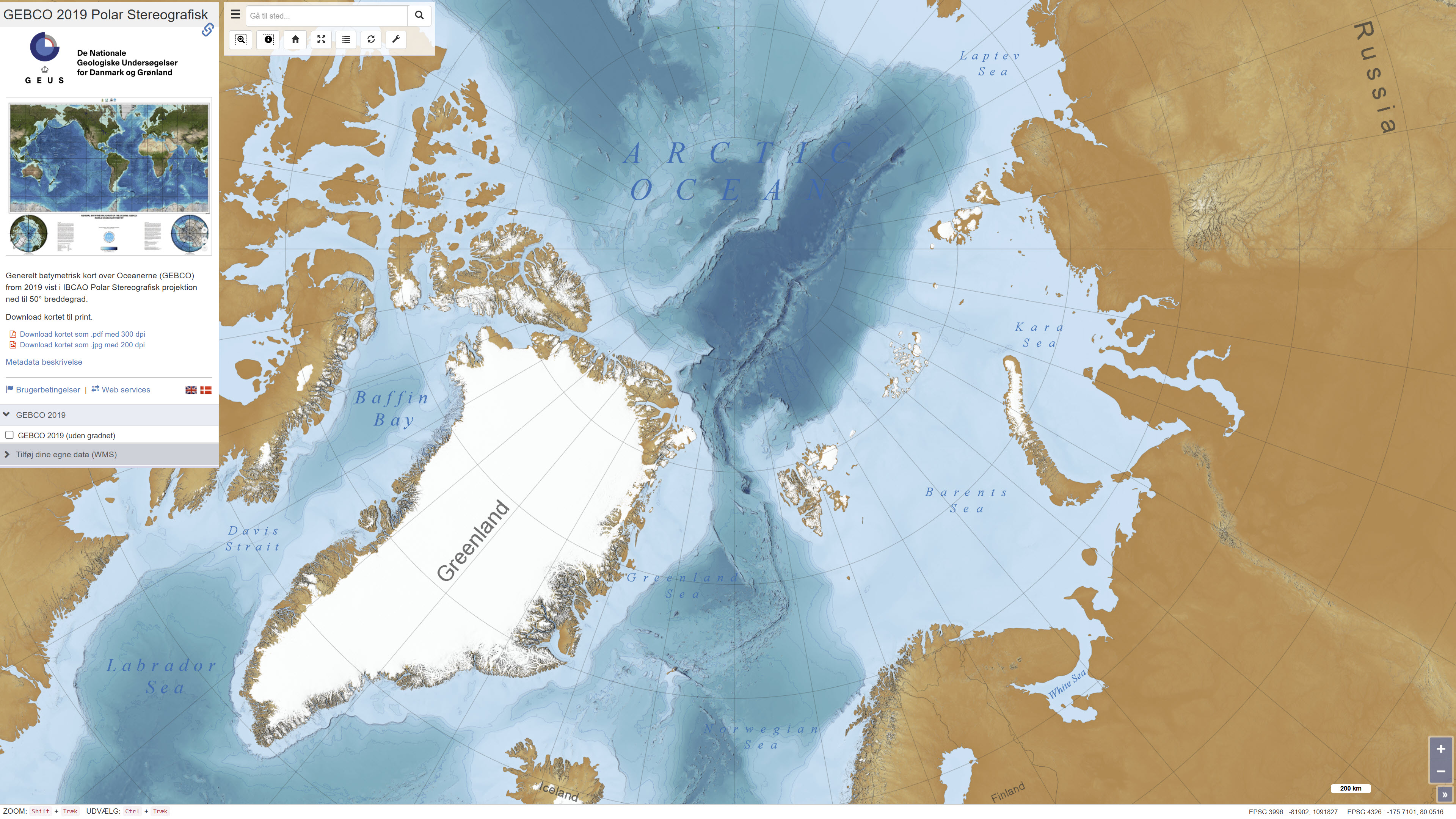
General Bathymetric Chart of the Oceans (2019) Polar Stereographic
The dataset shows global bathymetry based on The General Bathymetric Chart of the Oceans (GEBCO) 2019. The dataset represents a continuous model of seafloor topography derived from a combination of multibeam, singlebeam and satellite altimetry data. The dataset has been reprojected to a polar stereographic projection and published as a web-based background map for use in the ISAAFFIK Arctic Gateway portal.
Simple
Identifikation
- Titel
-
General Bathymetric Chart of the Oceans (2019) Polar Stereographic
Offentliggørelsestidspunkt
- Dato (Publication)
- 2021-04-01
Ansvarlig myndighed og kontaktoplysninger
- Kontakt vedr. service
-
Organisationsnavn E-mail adresse Rolle The Geological Survey of Denmark and Greenland (GEUS)
Point of contact Isaaffik Arctic Gateway
User
- Metadata author
-
Organisationsnavn E-mail adresse Rolle The Geological Survey of Denmark and Greenland (GEUS)
Point of contact
Geografisk udstrækning
- Koordinatsystem
-
WGS 84 / IBCAO Polar Stereographic (EPSG:3996)
Nøgleord
- Nøgleord
-
Dataset
- Nøgleord
-
GEBCO
- Nøgleord
-
ISSAFFIK
- Nøgleord
-
Bathymetry
- Nøgleord
-
Basemap
- Type
- Theme
- Nøgleord
- Geoscience and history policy
- Nøgleord
- Marine geology
- Type
- Theme
- Titel
- Forskningsemner
- Dato (Publication)
- 2025-11-03
- Nøgleord
- Greenland
- Nøgleord
- Arctic Ocean
- Type
- Place
- Titel
- Geografisk
- Dato (Publication)
- 2025-12-11
Kvalitet
- Type som metadata beskriver
- Dataset
- Beskrivelse
-
The GEBCO_2019 Grid is released by the General Bathymetric Chart of the Oceans (GEBCO) and has been developed through the Nippon Foundation-GEBCO Seabed 2030 Project with all rights reserved. The Seabed 2030 Project aims to bring together all available bathymetric data to produce the definitive map of the world ocean floor and make it available to all.
The GEBCO_2019 product provides global coverage with a continuous, global terrain model for ocean and land with a spatial resolution of 15 arc-seconds grid. It consists of 86400 rows x 43200 columns, giving 3,732,480,000 data points. The data values are pixel-center registered i.e. they refer to elevations at the center of grid cells.
The grid uses as a ‘base’ Version 1 of the SRTM15+ data set (Olson et al, 2014). This data set is a fusion of land topography with measured and estimated seafloor topography. It is largely based on version 11 of SRTM30+ (Becker et al, 2009; Sandwell et al, 2014), augmented with the gridded bathymetric data sets developed by the four Seabed 2030 Regional Centers. The published data were recalculated on a cell-registered grid for use by GEBCO.
The majority of the work, for the non-polar regions, was done using the 'remove-restore' procedure (Smith and Sandwell, 1997; Becker, Sandwell and Smith, 2009 and Hell and Jakobsson, 2011). This is a two-stage process of computing the difference between the new data and the 'base' grid, gridding the difference and adding this difference back to the existing base grid. The aim is to achieve a smooth transition between the 'new' and 'base' data sets with the minimum of perturbation of the existing base data set.
For the polar data sets, and the adjoining North Sea, are supplied in the form of complete grids. These data sets were included using feather blending techniques from GlobalMapper software version 11.01, made available by Blue Marble Geographic.
%20Polar%20stereografisk%20-%20print.jpg)
)))
