 geodata-info
Geochemical analyses of soil samples from Greenland
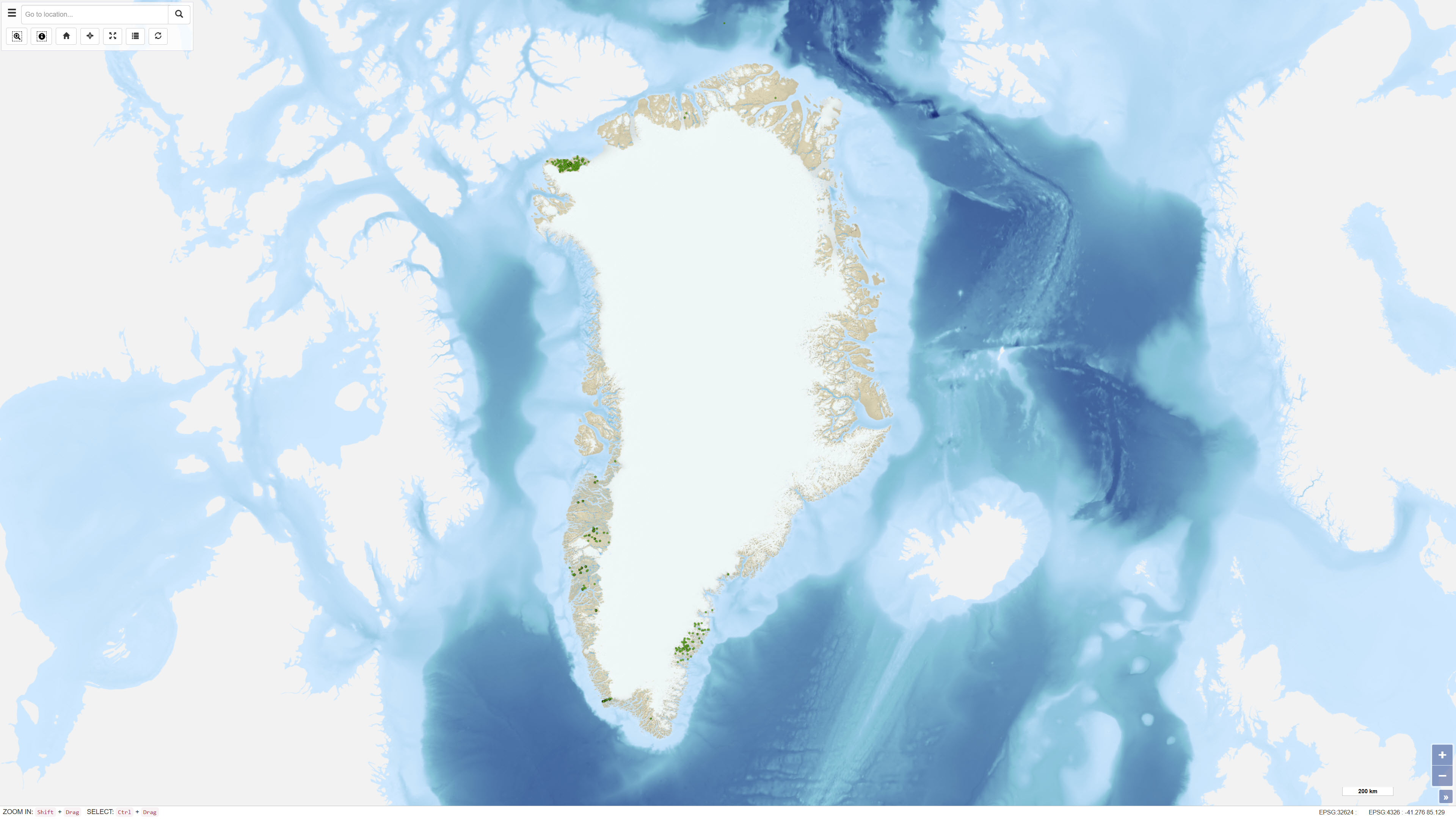
The dataset comprises geochemical analyses of 1,269 soil samples collected in Greenland from 1974 onwards as part of systematic geochemical mapping and mineral exploration programmes. Soil samples were primarily collected in areas lacking developed stream channels where stream sediment sampling was not feasible. The samples represent surface material and have been analysed for major and trace elements using various laboratory methods including X-ray Fluorescence Spectrometry (XRF), Instrumental Neutron Activation Analysis (INA), Inductively Coupled Plasma Emission Spectrometry (ICP), and Atomic Absorption Spectrometry (AAS). The dataset contains the original analytical results as received from the laboratories together with administrative information on sample location and analysed grain-size fraction. The data form part of the analytical basis for the Geochemical Atlas of West and South Greenland.
Simple
Identifikation
- Titel
-
Geochemical analyses of soil samples from Greenland
Offentliggørelsestidspunkt
- Dato (Publication)
- 2022-01-01
Ansvarlig myndighed og kontaktoplysninger
- Kontakt vedr. service
-
Organisationsnavn E-mail adresse Rolle The Geological Survey of Denmark and Greenland (GEUS)
Point of contact
- Metadata author
-
Organisationsnavn E-mail adresse Rolle The Geological Survey of Denmark and Greenland (GEUS)
Point of contact
Geografisk udstrækning
- Koordinatsystem
-
WGS 84 / UTM 24N (EPSG:32624)
Nøgleord
- Nøgleord
-
Dataset
- Nøgleord
-
Geochemistry
- Nøgleord
-
Soil samples
- Nøgleord
-
Trace elements
- Nøgleord
-
Greenland
- Nøgleord
-
Database
- Type
- Theme
- Nøgleord
- Sedimentary rocks and processes
- Nøgleord
- Soils and biogeochemistry
- Type
- Theme
- Titel
- Forskningsemner
- Dato (Publication)
- 2025-11-03
- Nøgleord
- Greenland
- Type
- Place
- Titel
- Geografisk
- Dato (Publication)
- 2025-12-11
Kvalitet
- Type som metadata beskriver
- Dataset
- Beskrivelse
-
Soil samples were collected from 1974 onwards as part of regional geochemical mapping and mineral exploration programmes in Greenland. Sampling density was typically one sample per 20–30 km² of ice-free terrain. Samples were dried, sieved and in some cases processed to obtain specific grain-size fractions prior to chemical analysis. Analytical work was carried out at different laboratories using evolving analytical techniques. To ensure comparability between analytical batches, quality control and calibration against internal and international standards were performed, including regression adjustments to reference values as documented in GEUS Report 1999/41 and its supplement Report 2001/47 . Values below the lower limit of detection are recorded as zero in the dataset. For some older analyses, information on detection limits may be incomplete. Coordinate determinations made prior to 2000 were subsequently revised following expert review.
)))
