 geodata-info
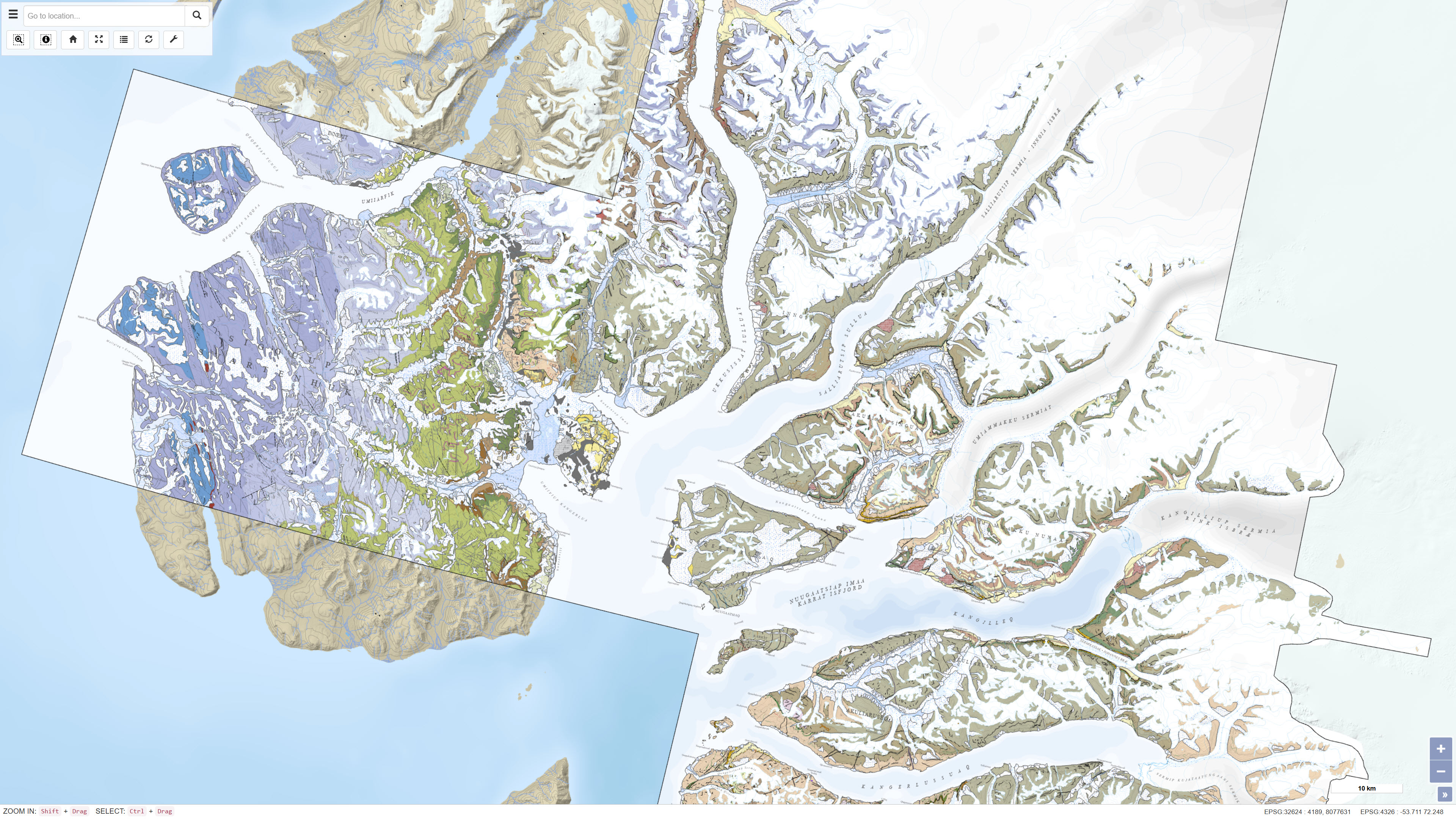
Geological map of the Karrat area 1:100 000
This dataset contains a seamless digital geological map of the Karrat area in central West Greenland based on four geological map sheets at a scale of 1:100 000: Maarmorilik 71 V.2 South, Nuugaatsiaq 71 V.2 North, Pannertooq 72 V.2 South and Svartenhuk 71 V.1 North. Geological mapping was carried out in the fjord regions north of Uummannaq as part of a collaborative project between the Geological Survey of Denmark and Greenland (GEUS) and the Ministry of Mineral Resources and Justice of Greenland. The dataset is based on 3D photogeology using more than 35,000 oblique photographs collected during three field seasons combined with traditional field observations and subsequent geochemical and geochronological analyses. The dataset provides an updated geological understanding of the meta-sedimentary and meta-volcanic rocks of the Karrat Group, the structural evolution of the Rinkian Orogen and the structure of the West Greenland Basalt Group. The dataset supports geological research, regional geological mapping and mineral exploration.
Simple
Identifikation
- Titel
-
Geological map of the Karrat area 1:100 000
Offentliggørelsestidspunkt
- Dato (Publication)
- 2025-01-01
Ansvarlig myndighed og kontaktoplysninger
- Kontakt vedr. service
-
Organisationsnavn E-mail adresse Rolle The Geological Survey of Denmark and Greenland (GEUS)
Point of contact
- Metadata author
-
Organisationsnavn E-mail adresse Rolle The Geological Survey of Denmark and Greenland (GEUS)
Point of contact
Geografisk udstrækning
- Koordinatsystem
-
WGS 84 / UTM 24N (EPSG:32624)
Nøgleord
- Nøgleord
-
Dataset
- Nøgleord
-
Geology
- Nøgleord
-
Geological maps
- Nøgleord
-
Karrat
- Nøgleord
-
West Greenland
- Nøgleord
-
Stratigraphy
- Nøgleord
-
Structural geology
- Type
- Theme
- Nøgleord
- Tectonics and structural geology
- Nøgleord
- Stratigraphy and correlation
- Type
- Theme
- Titel
- Forskningsemner
- Dato (Publication)
- 2025-11-03
- Nøgleord
- Greenland
- Type
- Place
- Titel
- Geografisk
- Dato (Publication)
- 2025-12-11
Kvalitet
- Type som metadata beskriver
- Dataset
- Beskrivelse
-
The dataset is based on geological mapping carried out by GEUS in collaboration with the Ministry of Mineral Resources and Justice of Greenland in the fjord regions north of Uummannaq in central West Greenland. Mapping included 3D photogeological interpretation based on more than 35,000 oblique photographs collected during three field seasons combined with traditional field observations. In addition, more than 700 samples were analysed for geochemistry and nearly 100 samples were analysed for geochronology. The dataset compiles and harmonises four geological map sheets at a scale of 1:100 000 into a seamless digital map product.
)))
