 geodata-info
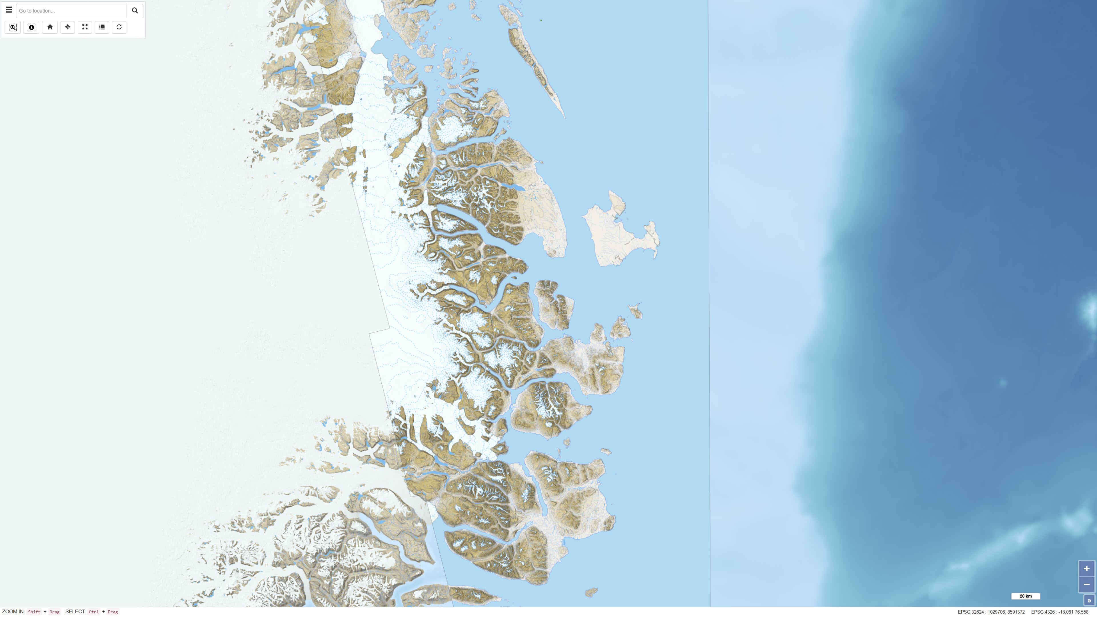
Topographic map of Northeast Greenland
The dataset comprises a topographic map of Northeast Greenland delivered as a digital elevation model (DEM) with a spatial resolution of 8 metres. The DEM is provided as GeoTIFF and represents a seamless elevation surface covering the study area.
The dataset was produced using input data from the ArcticDEM project, which is based on stereo imagery from the DigitalGlobe WorldView-1, WorldView-2 and WorldView-3 satellites. The elevation model integrates selected DEM strips recorded between 2012 and 2015 and has been processed to ensure consistency and continuity across the mosaic.
Simple
Identifikation
- Titel
-
Topographic map of Northeast Greenland
Offentliggørelsestidspunkt
- Dato (Publication)
- 2022-01-01
Ansvarlig myndighed og kontaktoplysninger
- Kontakt vedr. service
-
Organisationsnavn E-mail adresse Rolle The Geological Survey of Denmark and Greenland (GEUS)
Point of contact The Geological Survey of Denmark and Greenland (GEUS)
Distributor
- Metadata author
-
Organisationsnavn E-mail adresse Rolle The Geological Survey of Denmark and Greenland (GEUS)
Point of contact
Geografisk udstrækning
- Koordinatsystem
-
WGS 84 / UTM 24N (EPSG:32624)
Nøgleord
- Nøgleord
-
Dataset
- Nøgleord
-
Topography
- Nøgleord
-
Digital elevation model
- Nøgleord
-
Northeast Greenland
- Nøgleord
-
ArcticDEM
- Nøgleord
-
Terrain
- Type
- Theme
- Nøgleord
- Geoscience and history policy
- Type
- Theme
- Titel
- Forskningsemner
- Dato (Publication)
- 2025-11-03
- Nøgleord
- Greenland
- Type
- Place
- Titel
- Geografisk
- Dato (Publication)
- 2025-12-11
Kvalitet
- Type som metadata beskriver
- Dataset
- Beskrivelse
-
The digital elevation model was generated using input data from the ArcticDEM project, which is based on stereo satellite imagery from the DigitalGlobe WorldView-1, WorldView-2 and WorldView-3 platforms. The input DEM strip files have a spatial resolution of 8 metres and are referenced to the WGS84 ellipsoid.
DEM data used in the production of the dataset were recorded between 2012 and 2015. Selection of DEM strips prior to mosaicking was based on assessment of vertical consistency in overlapping areas, data quality, recording date with preference for ice-free summer months, and acquisition geometry including nadir angle.
Not all input DEM strips were provided with unique xyz shifts relative to ICESat reference data. Therefore, a co-registration workflow was established in which all DEM strips were co-registered without the use of external reference data. Co-registration was carried out using the OPALS software (opalsGeoref package) applying least-squares matching of overlapping areas to determine optimal shifts. Seamless mosaicking was subsequently performed using ENVI 5.4, applying a median filter with a 3×3 kernel.
)))
