 geodata-info
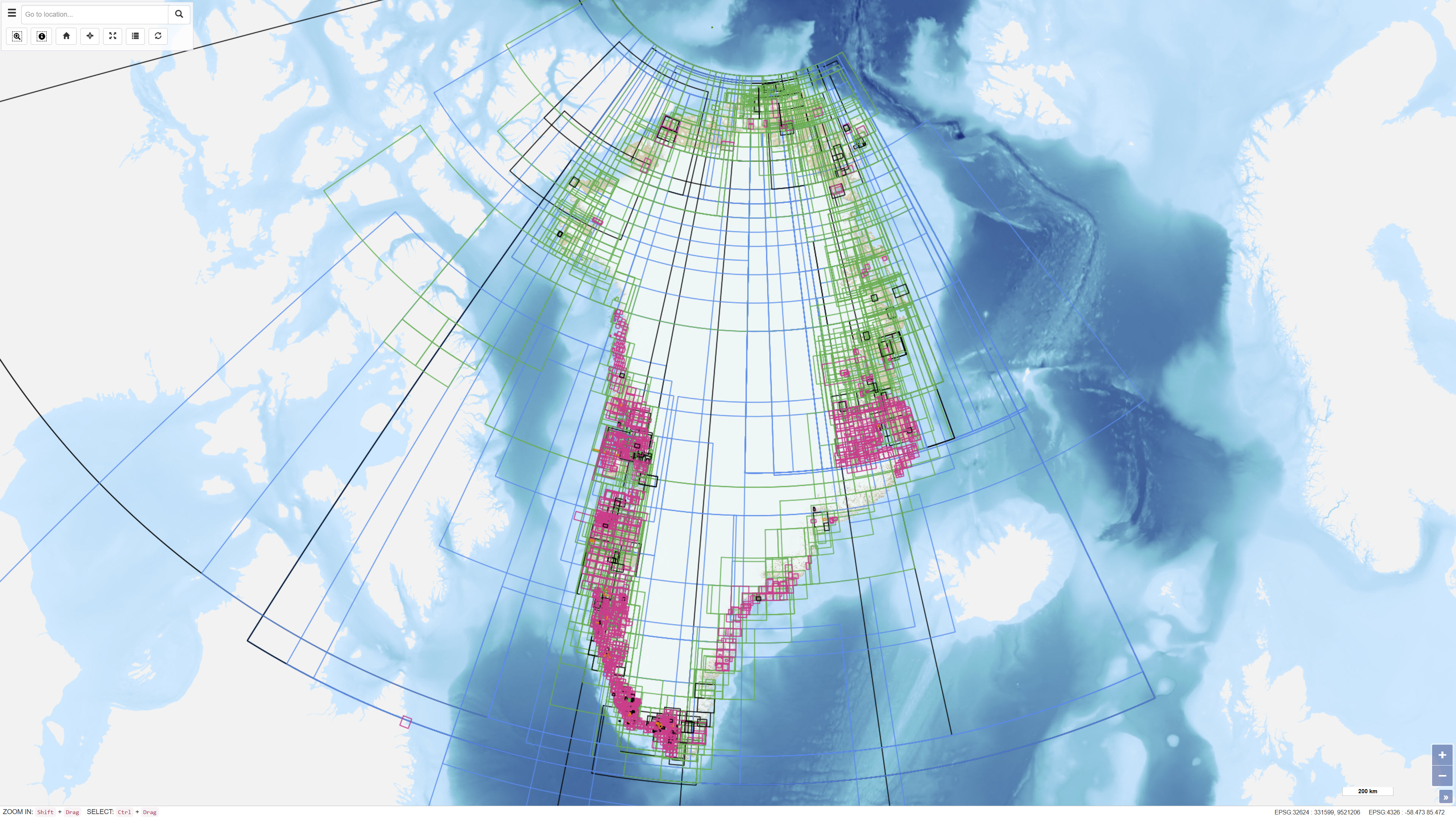
Index Layer of Archived Unpublished Historical Geological Maps and Sections from Greenland
The dataset represents an index layer showing the geographic extent of archived and unpublished historical geological maps and sections from Greenland. The layer functions as a search and reference tool and does not contain the original map material. The dataset supports identification and access to historical geological archive documents.
Simple
Identifikation
- Titel
-
Index Layer of Archived Unpublished Historical Geological Maps and Sections from Greenland
Offentliggørelsestidspunkt
- Dato (Publication)
- 2022-01-01
Ansvarlig myndighed og kontaktoplysninger
- Kontakt vedr. service
-
Organisationsnavn E-mail adresse Rolle The Geological Survey of Denmark and Greenland (GEUS)
Point of contact
- Metadata author
-
Organisationsnavn E-mail adresse Rolle The Geological Survey of Denmark and Greenland (GEUS)
Point of contact
Geografisk udstrækning
- Koordinatsystem
-
WGS 84 / UTM 24N (EPSG:32624)
Nøgleord
- Nøgleord
-
Dataset
- Nøgleord
-
Geological Maps
- Nøgleord
-
Historical Maps
- Nøgleord
-
Archive
- Nøgleord
-
Unpublished Maps
- Nøgleord
-
Greenland
- Type
- Theme
- Nøgleord
- Economic geology
- Nøgleord
- Stratigraphy and correlation
- Nøgleord
- Tectonics and structural geology
- Type
- Theme
- Titel
- Forskningsemner
- Dato (Publication)
- 2025-11-03
- Nøgleord
- Greenland
- Type
- Place
- Titel
- Geografisk
- Dato (Publication)
- 2025-12-11
Kvalitet
- Type som metadata beskriver
- Dataset
- Beskrivelse
-
The dataset has been established as a digital index layer based on records of archived and unpublished geological maps and sections. Geographic outlines have been digitised or registered to represent the spatial extent of the associated archive material. The dataset does not contain the original map data.
)))
