 geodata-info
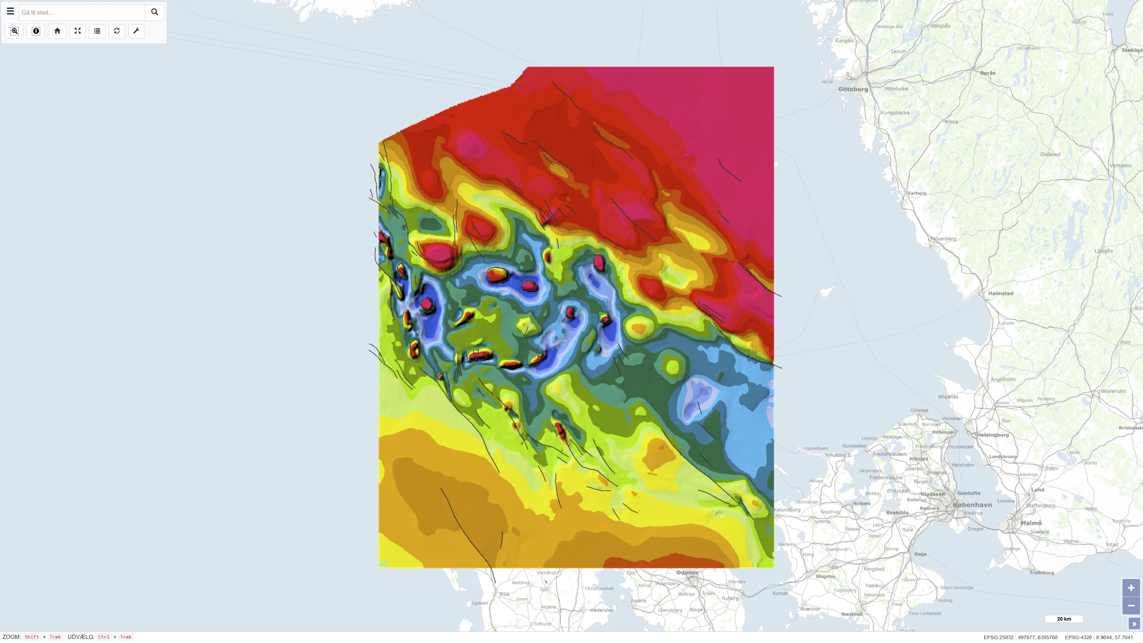
Geological map of Denmark, 1:500,000 – The Danish Basin: Structural map of the Top Chalk
The dataset comprises a geological structural map of the Danish Basin at a scale of 1:500,000 showing the structure of the chalk surface (Top Chalk). The map was published in 1991 as part of the DGU Map Series no. 7 and is based on regional geological interpretation of borehole data and seismic data. The data basis includes deep onshore boreholes, seismic profiles from hydrocarbon exploration, and seismic surveys from the inner Danish waters. The map covers Denmark and adjacent marine areas and was produced to support regional geological understanding of the structure of the chalk surface in the Danish Basin.
Simple
Identifikation
- Titel
-
Geological map of Denmark, 1:500,000 – The Danish Basin: Structural map of the Top Chalk
Offentliggørelsestidspunkt
- Dato (Publication)
- 1990-09-03
Ansvarlig myndighed og kontaktoplysninger
- Kontakt vedr. service
-
Organisationsnavn E-mail adresse Rolle The Geological Survey of Denmark and Greenland (GEUS)
Point of contact
- Metadata author
-
Organisationsnavn E-mail adresse Rolle The Geological Survey of Denmark and Greenland (GEUS)
Point of contact
Geografisk udstrækning
- Koordinatsystem
-
ETRS 89 / UTM 32N (EPSG:25832)
Nøgleord
- Nøgleord
-
Dataset
- Nøgleord
-
Geology
- Nøgleord
-
Top Chalk
- Nøgleord
-
Danish Basin
- Nøgleord
-
Chalk Group
- Nøgleord
-
Denmark
- Type
- Theme
- Nøgleord
- Stratigraphy and correlation
- Nøgleord
- Geoscience and history policy
- Nøgleord
- Tectonics and structural geology
- Type
- Theme
- Titel
- Forskningsemner
- Dato (Publication)
- 2025-11-03
- Nøgleord
- Denmark
- Type
- Place
- Titel
- Geografisk
- Dato (Publication)
- 2025-12-11
Kvalitet
- Type som metadata beskriver
- Dataset
- Beskrivelse
-
The map was published as DGU Map Series no. 7 in 1991 and was produced based on interpretation of borehole data and seismic data acquired over a period of approximately 15–20 years prior to publication. The data basis includes around 75 deep onshore boreholes and approximately 4,000 km of seismic profiles from hydrocarbon exploration, supplemented by seismic surveys from the inner Danish waters. Existing geological maps from adjacent areas were also incorporated to ensure regional structural consistency. The dataset represents the geological interpretation available at the time of publication.
)))
