 geodata-info
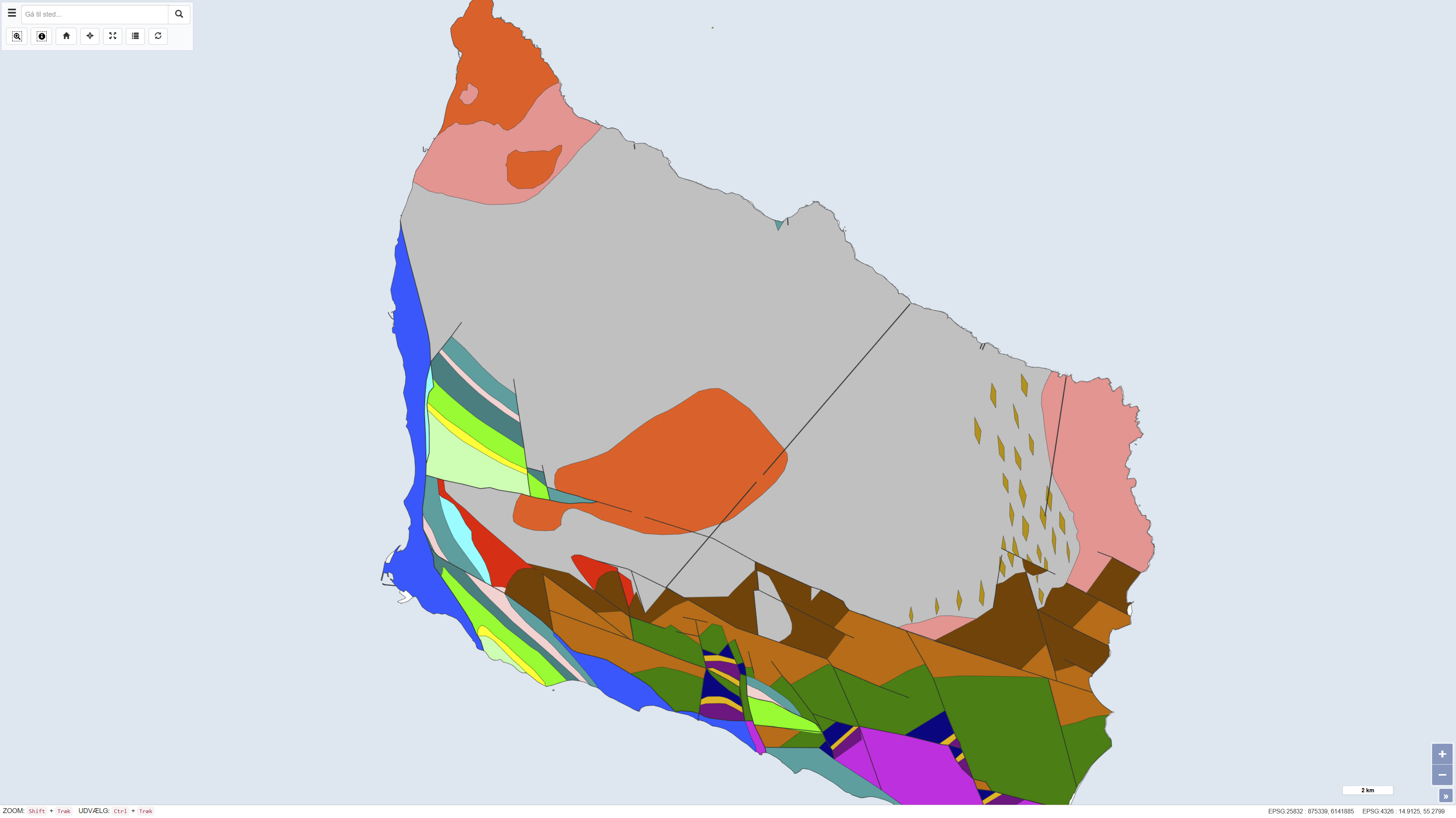
Pre-Quaternary surface of Bornholm
The dataset shows the pre-Quaternary surface of Bornholm and illustrates the distribution of pre-Quaternary rock units and geological structures beneath the Quaternary deposits. The map is based on geological interpretations carried out by Helge Gry in 1960 and 1969 and was published in the journal VARV in 1977. The pre-Quaternary geology of Bornholm differs significantly from the rest of Denmark and is characterised by complex fault systems and a combination of crystalline basement and sedimentary rocks. The map represents a historical, synthesised overview of the pre-Quaternary surface and remains an important reference in geological studies.
Simple
Identifikation
- Titel
-
Pre-Quaternary surface of Bornholm
Offentliggørelsestidspunkt
- Dato (Publication)
- 1977-01-01
Ansvarlig myndighed og kontaktoplysninger
- Kontakt vedr. service
-
Organisationsnavn E-mail adresse Rolle The Geological Survey of Denmark and Greenland (GEUS)
Point of contact
- Metadata author
-
Organisationsnavn E-mail adresse Rolle The Geological Survey of Denmark and Greenland (GEUS)
Point of contact
Geografisk udstrækning
- Koordinatsystem
-
ETRS 89 / UTM 32N (EPSG:25832)
Nøgleord
- Nøgleord
-
Dataset
- Nøgleord
-
Geology
- Nøgleord
-
Bornholm
- Nøgleord
-
ArcGIS
- Nøgleord
-
Pre-Quaternary
- Nøgleord
-
Surface
- Type
- Theme
- Nøgleord
- Stratigraphy and correlation
- Nøgleord
- Tectonics and structural geology
- Nøgleord
- Geoscience and history policy
- Type
- Theme
- Titel
- Forskningsemner
- Dato (Publication)
- 2025-11-03
- Nøgleord
- Denmark
- Type
- Place
- Titel
- Geografisk
- Dato (Publication)
- 2025-12-11
Kvalitet
- Type som metadata beskriver
- Dataset
- Beskrivelse
-
The map is based on geological mapping and interpretations carried out by Helge Gry in 1960 and 1969. The data foundation includes field observations, geological profiles, borehole information, and structural analyses representing the best available knowledge of Bornholm’s pre-Quaternary geology at the time. The map was editorially processed and published in VARV in 1977. The dataset is a historical product and is not subject to continuous updates.
)))
