 geodata-info
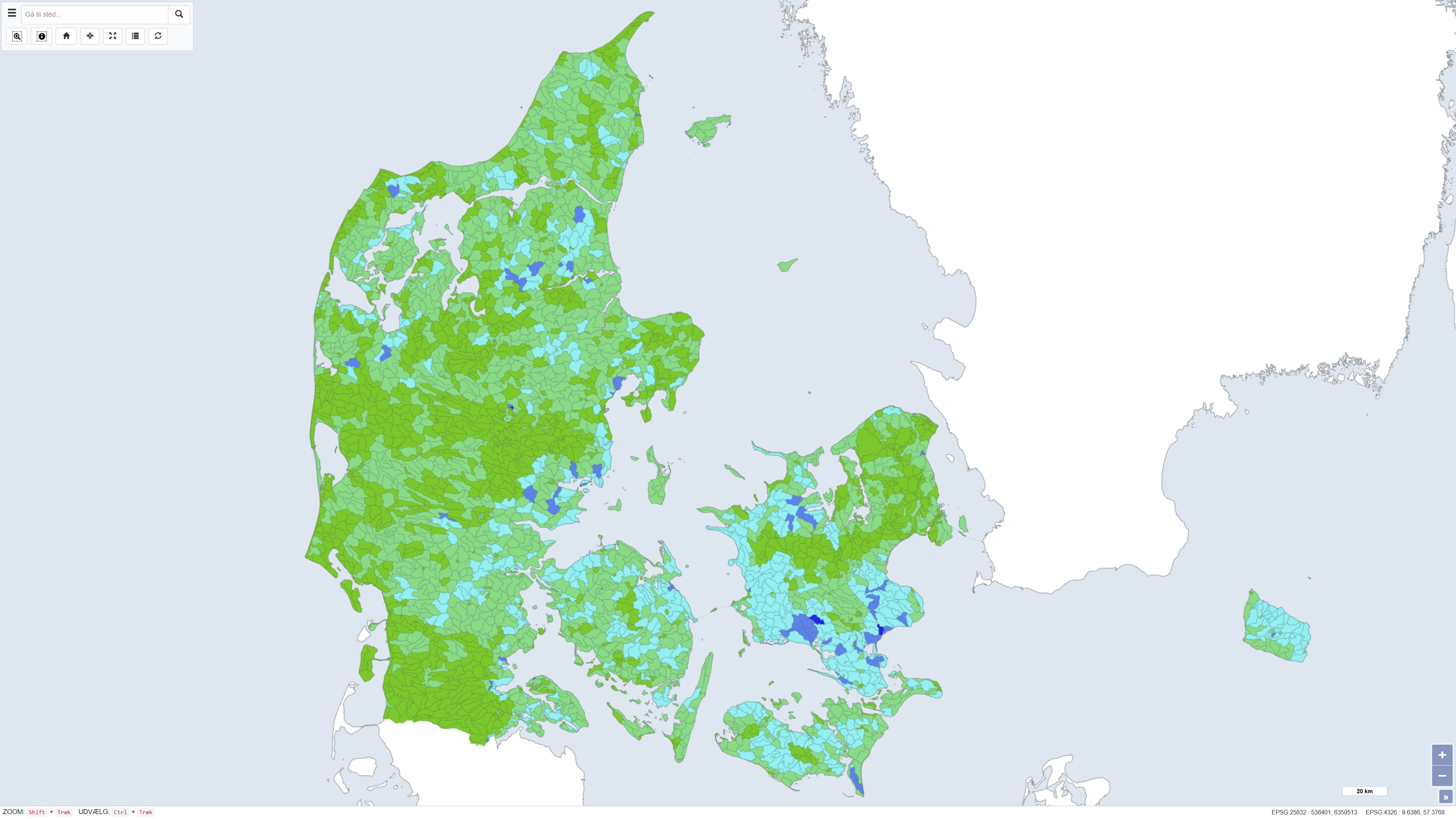
Nitrogen retention from the National Nitrogen Model
This dataset shows the percentage nitrogen retention in Denmark, i.e. the proportion of nitrogen leached from the root zone that is transformed or retained in the subsurface and surface waters before reaching the coast. Nitrogen retention is calculated using the National Nitrogen Model and represents an average retention for the period 1990–2010. The dataset provides nationwide coverage of spatial variations in nitrogen retention and is used as a basis for assessing nitrogen transport and coastal nutrient loading.
The National Nitrogen Model version 2020 is documented in National Nitrogen Model – version 2020, a GEUS special report, including a method report (ISBN 978-87-7871-551-7) and an appendix (ISBN 978-87-7871-552-4), both available from GEUS (in danish).
Simple
Identifikation
- Titel
-
Nitrogen retention from the National Nitrogen Model
Offentliggørelsestidspunkt
- Dato (Publication)
- 2020-12-15
Ansvarlig myndighed og kontaktoplysninger
- Kontakt vedr. service
-
Organisationsnavn E-mail adresse Rolle The Geological Survey of Denmark and Greenland (GEUS)
Point of contact The Geological Survey of Denmark and Greenland (GEUS)
Author Aarhus University
Author
- Metadata author
-
Organisationsnavn E-mail adresse Rolle The Geological Survey of Denmark and Greenland (GEUS)
Point of contact
Geografisk udstrækning
- Koordinatsystem
-
ETRS 89 / UTM 32N (EPSG:25832)
Nøgleord
- Nøgleord
-
Dataset
- Nøgleord
-
Nitrogen retention
- Nøgleord
-
Aquatic environment
- Nøgleord
-
Nutrients
- Nøgleord
-
Denmark
- Type
- Theme
- Nøgleord
- Soils and biogeochemistry
- Nøgleord
- Hydrology
- Type
- Theme
- Titel
- Forskningsemner
- Dato (Publication)
- 2025-11-03
- Nøgleord
- Denmark
- Type
- Place
- Titel
- Geografisk
- Dato (Publication)
- 2025-12-11
Kvalitet
- Type som metadata beskriver
- Dataset
- Beskrivelse
-
The dataset was developed during the period mid-2013 to early 2015 by GEUS in collaboration with Aarhus University (DCE and DCA) as part of the work on the National Nitrogen Model. The map was subsequently revised in August 2015. Nitrogen retention is calculated using the National Nitrogen Model and represents model-based estimates of nitrogen transport and reduction from the root zone through groundwater and surface waters to the coast. The dataset is based on a subdivision into ID15 catchments and reflects the assumptions and data basis applied in the model at the time of calculation.
)))
