 geodata-info
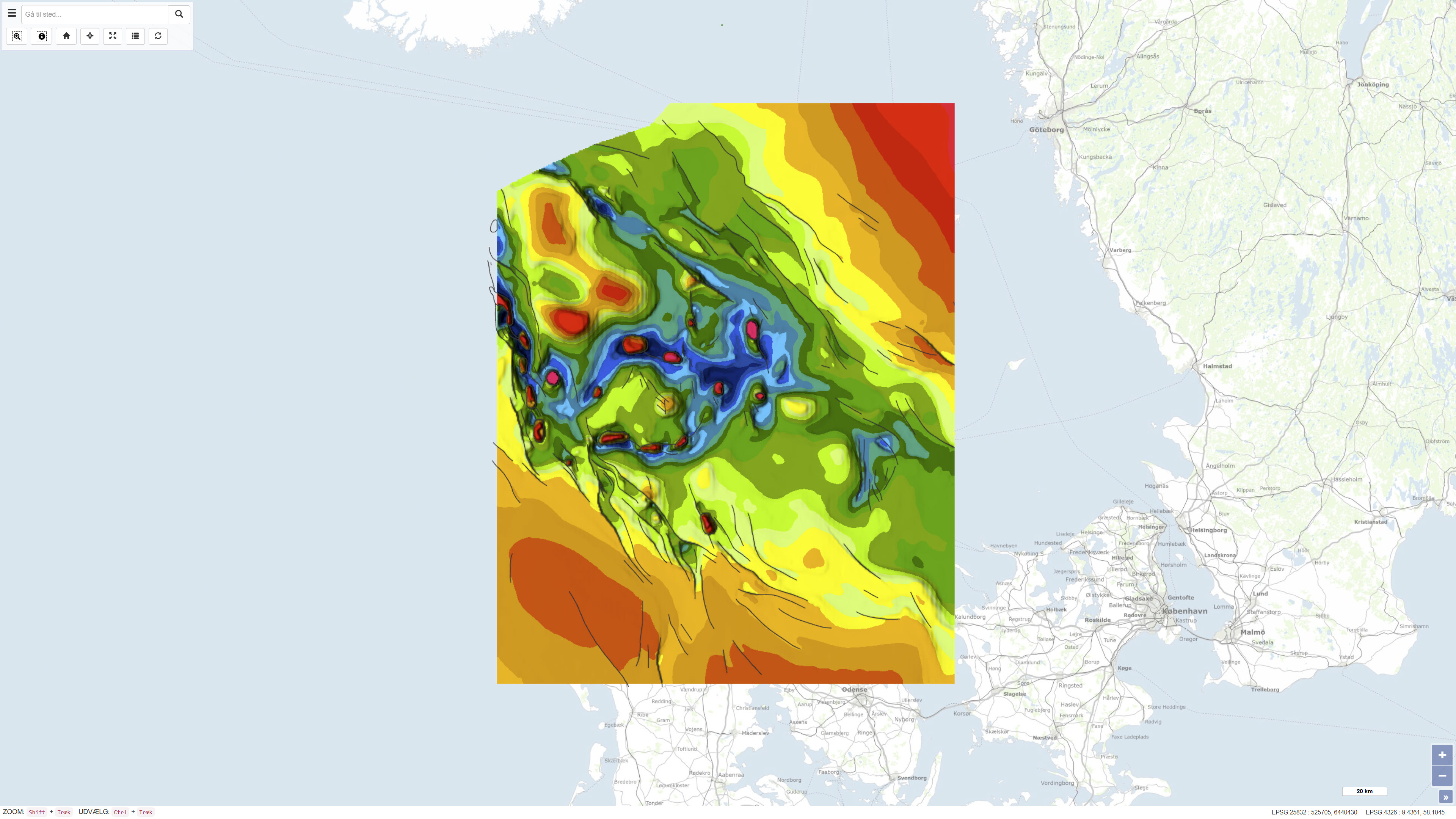
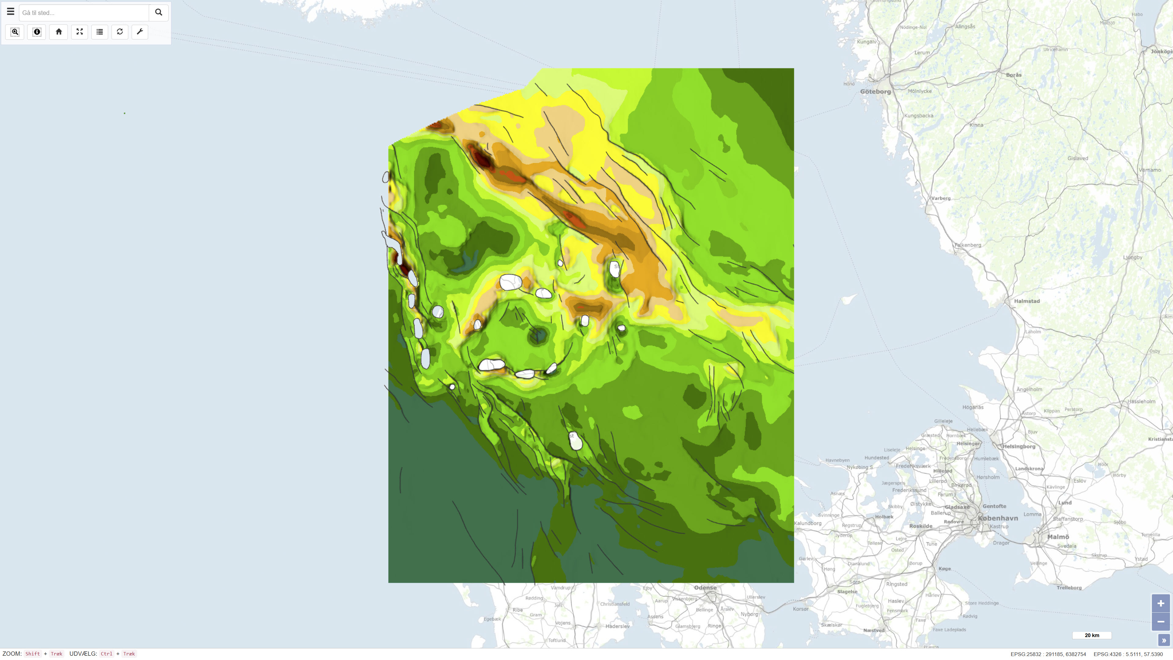
Geological Map of Denmark, 1:400.000 - The Danish Basin: Top Triassic and Jurassic–Lower Cretaceous
The dataset comprises a combined geological map of the Danish Basin showing the distribution, depth conditions, and thickness variations of the Top Triassic and Jurassic–Lower Cretaceous units. The maps illustrate the regional structure and stratigraphic framework of the basin and provide an overview of its geological development from the Late Triassic to the Early Cretaceous. The presentation is based on a synthesis of borehole data, seismic information, and stratigraphic interpretations and is produced at a scale of 1:400.000. The maps were published in 1991 as part of the DGU Map Series No. 30.
Simple
Identifikation
- Titel
-
Geological Map of Denmark, 1:400.000 - The Danish Basin: Top Triassic and Jurassic–Lower Cretaceous
Offentliggørelsestidspunkt
- Dato (Publication)
- 1991-01-01
Ansvarlig myndighed og kontaktoplysninger
- Kontakt vedr. service
-
Organisationsnavn E-mail adresse Rolle The Geological Survey of Denmark and Greenland (GEUS)
Point of contact
- Metadata author
-
Organisationsnavn E-mail adresse Rolle The Geological Survey of Denmark and Greenland (GEUS)
Point of contact
Geografisk udstrækning
- Koordinatsystem
-
ETRS 89 / UTM 32N (EPSG:25832)
Nøgleord
- Nøgleord
-
Dataset
- Nøgleord
-
Top Triassic
- Nøgleord
-
Jurassic
- Nøgleord
-
Lower Cretaceous
- Nøgleord
-
Danish Basin
- Nøgleord
-
Pre-Quaternary geology
- Nøgleord
-
Denmark
- Type
- Theme
- Nøgleord
- Tectonics and structural geology
- Nøgleord
- Geoscience and history policy
- Nøgleord
- Stratigraphy and correlation
- Type
- Theme
- Titel
- Forskningsemner
- Dato (Publication)
- 2025-11-03
- Nøgleord
- Denmark
- Type
- Place
- Titel
- Geografisk
- Dato (Publication)
- 2025-12-11
Kvalitet
- Type som metadata beskriver
- Dataset
- Beskrivelse
-
The maps were produced by the Geological Survey of Denmark (DGU) based on an integrated assessment of available borehole data, seismic information, previous geological maps, and stratigraphic analyses. The data were compiled and interpreted to produce regional depth and thickness maps of the Top Triassic and Jurassic–Lower Cretaceous units within the Danish Basin. The work represents a synthesis of the best available knowledge at the time of publication and was published in 1991 as part of the DGU Map Series No. 30. The dataset is a historical product and is not subject to continuous updates.
)))
