 geodata-info
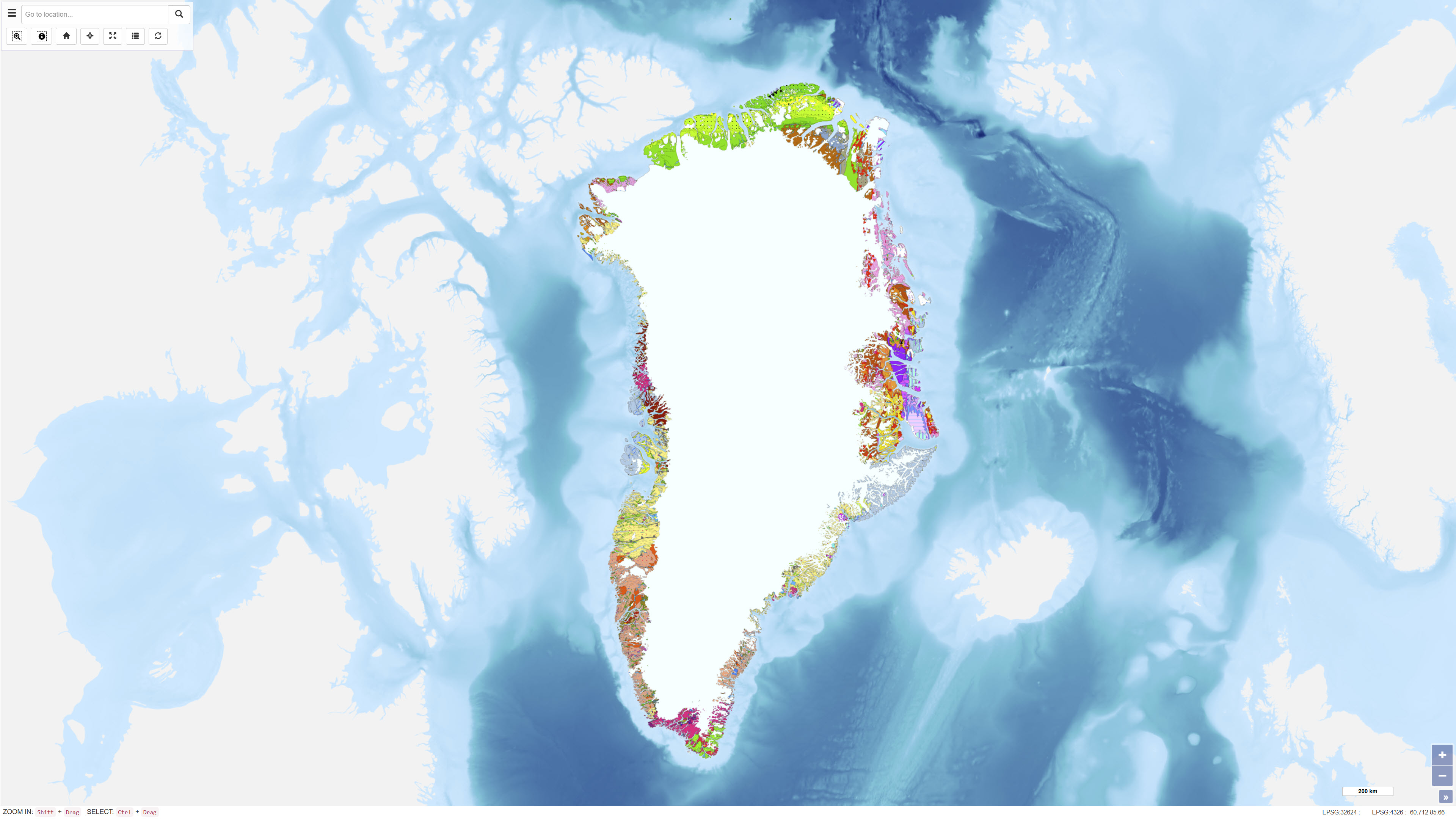
Provinces based on the Geological map of Greenland 1:2.500.000
The main geological environments in Greenland and their mineral resources have been described and divided into four main geological environments: infracrustal regions, supracrustal regions, magmatic provinces and sedimentary basin regions. Within the various geological environments, characteristic mineral deposits are outlined.
Within the infracrustal environment, relatively few mineral occurrences are recorded in Greenland, but three types are described: gold in gneiss, nickel and copper in mafic intrusions, and olivine in ultramafic rocks.
For more detailed information, reference is made to the report Greenland geological environments and mineral resources.
Simple
Identifikation
- Titel
-
Provinces based on the Geological map of Greenland 1:2.500.000
Offentliggørelsestidspunkt
- Dato (Publication)
- 1998-01-01
Ansvarlig myndighed og kontaktoplysninger
- Kontakt vedr. service
-
Organisationsnavn E-mail adresse Rolle The Geological Survey of Denmark and Greenland (GEUS)
Point of contact The Geological Survey of Denmark and Greenland (GEUS)
Owner The Geological Survey of Denmark and Greenland (GEUS)
Distributor
- Metadata author
-
Organisationsnavn E-mail adresse Rolle The Geological Survey of Denmark and Greenland (GEUS)
Point of contact
Geografisk udstrækning
- Koordinatsystem
-
WGS 84 / UTM 24N (EPSG:32624)
Nøgleord
- Nøgleord
-
Dataset
- Nøgleord
-
Geology
- Nøgleord
-
Greenland
- Nøgleord
-
Geological provinces
- Nøgleord
-
Mineral resources
- Type
- Theme
- Nøgleord
- Stratigraphy and correlation
- Nøgleord
- Economic geology
- Nøgleord
- Tectonics and structural geology
- Type
- Theme
- Titel
- Forskningsemner
- Dato (Publication)
- 2025-11-03
- Nøgleord
- Greenland
- Type
- Place
- Titel
- Geografisk
- Dato (Publication)
- 2025-12-11
Kvalitet
- Type som metadata beskriver
- Dataset
- Beskrivelse
-
The dataset was derived from the Geological map of Greenland at a scale of 1:2.500.000. Geological provinces were defined through interpretation and generalisation of the geological units shown on the source map and grouped into major geological environments.
)))
